IMAGES TAKEN NEAR TO
Woodland Terrace, PONTYPOOL, NP4 8UY
Introduction
This page details the photographs taken nearby to Woodland Terrace, NP4 8UY by members of the Geograph project.
The Geograph project started in 2005 with the aim of publishing, organising and preserving representative images for every square kilometre of Great Britain, Ireland and the Isle of Man.

There are currently over 7.5m images from over14,400 individuals and you can help contribute to the project by visiting https://www.geograph.org.uk
Image Map
Images are licensed for reuse under creativecommons.org/licenses/by-sa/2.0
Notes
- Clicking on the map will re-center to the selected point.
- The higher the marker number, the further away the image location is from the centre of the postcode.
Image Listing (42 Images Found)
Images are licensed for reuse under creativecommons.org/licenses/by-sa/2.0
Image
Details
Distance
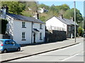
1
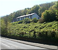
Woodland Terrace houses, Cwmavon
Viewed from Cwmavon Road (A4043).
Image: © Jaggery
Taken: 28 Apr 2011
0.04 miles
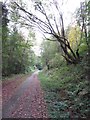
3
Southern boundary of Cwmavon
The A4043 from Abersychan reaches Cwmavon, a small community in the Afon Lwyd valley south of Blaenavon.
Image: © Jaggery
Taken: 28 Apr 2011
0.09 miles
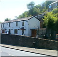
5
Cwmavon Road cottages, Cwmavon
Nearest the camera is The Cottage. Further away are Grove Cottage and Little Grove Cottage.
Image: © Jaggery
Taken: 28 Apr 2011
0.10 miles
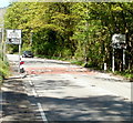
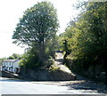
7
The Old Railway Cottage, Cwmavon
I was inclined to doubt the accuracy of the first reference I consulted, which named this roadside property as Old Railway Cottage. However, another source confirmed its name, and a 1940s map shows that Cwmavon (Mon) Halt railway station was a few metres away. The station closed in 1962.
The house on high ground is in Snail Creep Terrace.
Image: © Jaggery
Taken: 28 Apr 2011
0.16 miles
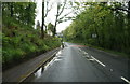
8
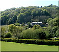
Hillside view, Cwmavon
Viewed from the eastern end of Llanover Lane looking towards and beyond Cwmavon Road.
Image: © Jaggery
Taken: 28 Apr 2011
0.16 miles
9
Snail Creep Terrace, Cwmavon
Viewed across Cwmavon Road. Snail Creep Terrace on the right begins a steep climb up to Varteg. http://www.geograph.org.uk/photo/1855978 to the Varteg end of Snail Creep Terrace.
Image: © Jaggery
Taken: 28 Apr 2011
0.16 miles
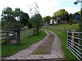
10
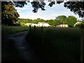
Beili Glas Farm stands out in the evening sun
While the lower part of the valley is already in deep shadow.
Image: © Carol Rose
Taken: 16 Jun 2007
0.16 miles