1
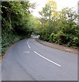
Track up from Limekiln Road
Track into woodland from B4246.
Image: © M J Roscoe
Taken: 23 Nov 2021
0.13 miles
2
Abersychan Fire Station, Limekiln Road
South Wales Fire & Rescue Service.
Image: © M J Roscoe
Taken: 23 Nov 2021
0.15 miles
3
Abersychan Fire Station
Abersychan Fire Station, Limekiln Road, Pontnewynydd is one of the 50 fire stations of the South Wales Fire & Rescue Service. This station was built in 1956.
Image: © Kevin Hale
Taken: 3 Jun 2007
0.15 miles
4
Abersychan Fire Station
The South Wales Fire and Rescue station is located on Limekiln Road (B4246). In addition to Abersychan, the station's coverage area includes Cwmffrwdoer, Garndiffaith, Pantygasseg, Pentwyn, Pontnewynydd, Talywain, Trevethin and Varteg.
Image: © Jaggery
Taken: 9 May 2011
0.17 miles
5
Redevelopment of Pleasant Court, Abersychan (1)
Refurbishment and redevelopment work is in progress. This is a view of the northern section of Pleasant Court, Limekiln Road. http://www.geograph.org.uk/photo/2401019 to the southern section.
Image: © Jaggery
Taken: 9 May 2011
0.17 miles
6
John Bingham Motor Repairs, Pontnewynydd
Business premises on Limekiln Road. The structure in the background at the right edge of the view is a disused lime kiln. http://www.geograph.org.uk/photo/2401053
Image: © Jaggery
Taken: 9 May 2011
0.17 miles
7
Disused lime kiln, Limekiln Road, Pontnewynydd
A metal grid blocks the entrance of a disused lime kiln on the east side of Limekiln Road.
Image: © Jaggery
Taken: 9 May 2011
0.18 miles
8
Redevelopment of Pleasant Court, Abersychan (2)
Refurbishment and redevelopment work is in progress. This is a view of the southern section of Pleasant Court, Limekiln Road. http://www.geograph.org.uk/photo/2401011 to the northern section.
Image: © Jaggery
Taken: 9 May 2011
0.18 miles
9
Wooded part of the B4246 Limekiln Road, Abersychan
The road is between the edge of a wood on the left and trees lining a bank of the Afon Lwyd on the right.
Image: © Jaggery
Taken: 2 Oct 2015
0.18 miles
10
Afon Lwyd, near Abersychan
Image: © Roger Cornfoot
Taken: 11 Apr 2007
0.18 miles


