1
Woodside Road houses, Trevethin
From the corner of Glen View Road.
Image: © Jaggery
Taken: 5 Dec 2016
0.02 miles
2
Dark green building near Woodside Road Allotments, Trevethin
Near the NW edge of a narrow strip of allotments extending for 200 metres alongside Woodside Road.
Image: © Jaggery
Taken: 5 Dec 2016
0.03 miles
3
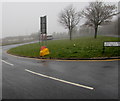
Yellow grit box, Glen View Road, Trevethin
At 275 metres (900 ft) above mean sea level, this northern part of Trevethin is one of the highest locations in Pontypool. Therefore the contents of the grit box are likely to be used to treat the road in icy or snowy conditions more often than in lower-lying areas.
Image: © Jaggery
Taken: 5 Dec 2016
0.03 miles
4
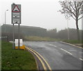
Humps warning sign facing Glen View Road, Trevethin
On the approach to Woodside Road, where there are humps across the road for 300 yards to the left and half a mile to the right. Viewed on a day of poor visibility caused by upland fog on December 5th 2016.
Image: © Jaggery
Taken: 5 Dec 2016
0.03 miles
5
Woodside Road, Trevethin
A road at the northern edge of Trevethin, here about 275 metres (900 ft) above mean sea level.
Image: © Jaggery
Taken: 5 Dec 2016
0.03 miles
6
Glenview Stores, Trevethin
Convenience store on the corner of Glen View Road and Beechwood Walk, at the northwest edge of Trevethin.
Image: © Jaggery
Taken: 5 Dec 2016
0.04 miles
7
Grass semicircle at the northern edge of Trevethin
Between Woodside Road and Glen View Road.
This turning area is near the northern terminus http://www.geograph.org.uk/photo/5217070 of Stagecoach bus route 15 from Newport.
Image: © Jaggery
Taken: 5 Dec 2016
0.05 miles
8
Trevethin Residents Organisation Office
The office is at the Glen View Road end of a block, next door to J. & J.A Grocers.
Image: © Jaggery
Taken: 12 May 2010
0.07 miles
9
Stagecoach bus at the Trevethin terminus
On a foggy day in early December 2016, Stagecoach single-decker fleet number 47532 is at the terminus of route 15 from Newport via Cwmbran, New Inn and central Pontypool. The location is between Glen View Road and Woodside Road, about 270 metres (c885 ft) above mean sea level.
Image: © Jaggery
Taken: 5 Dec 2016
0.07 miles
10
Foggy Beechwood Walk, Trevethin
Beechwood Walk (Rhodfa Coed Ffawydd in Welsh) viewed across Glen View Road at 11:55am on December 5th 2016. http://www.geograph.org.uk/photo/5217180 to improved visibility 20 minutes later.
Image: © Jaggery
Taken: 5 Dec 2016
0.08 miles


