IMAGES TAKEN NEAR TO
The Links, PONTYPOOL, NP4 8DQ
Introduction
This page details the photographs taken nearby to The Links, NP4 8DQ by members of the Geograph project.
The Geograph project started in 2005 with the aim of publishing, organising and preserving representative images for every square kilometre of Great Britain, Ireland and the Isle of Man.

There are currently over 7.5m images from over14,400 individuals and you can help contribute to the project by visiting https://www.geograph.org.uk
Image Map
Images are licensed for reuse under creativecommons.org/licenses/by-sa/2.0
Notes
- Clicking on the map will re-center to the selected point.
- The higher the marker number, the further away the image location is from the centre of the postcode.
Image Listing (33 Images Found)
Images are licensed for reuse under creativecommons.org/licenses/by-sa/2.0
Image
Details
Distance
3
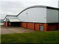
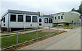
The Bowden Active Living Centre, Trevethin, Pontypool
The centre is in the NE corner of Ysgol Gyfun Gwynllyw. http://www.geograph.org.uk/photo/3415419 The Torfaen County Borough Council's Bowden centre is available to the general public after school hours from 5pm until 9pm.
Image: © Jaggery
Taken: 1 Jun 2011
0.16 miles
4
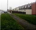
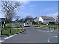
Woodside Road houses, Trevethin
From the corner of Glen View Road.
Image: © Jaggery
Taken: 5 Dec 2016
0.17 miles
6
Up Church Avenue, Trevethin
Church Avenue climbs away from this http://www.geograph.org.uk/photo/5227910 mini-roundabout
Image: © Jaggery
Taken: 5 Dec 2016
0.19 miles
7
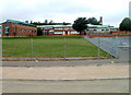
Ysgol Gyfun Gwynllyw, Trevethin, Pontypool
Viewed from Folly Road. Founded in 1988, Ysgol Gyfun Gwynllyw is a Welsh-medium comprehensive school.
Image: © Jaggery
Taken: 1 Jun 2011
0.19 miles
8
Trevethin Youth Centre, Pontypool
Located at the eastern edge of Ysgol Gyfun Gwynllyw. http://www.geograph.org.uk/photo/3415419
Image: © Jaggery
Taken: 1 Jun 2011
0.20 miles
9
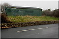
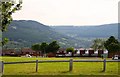
Dark green building near Woodside Road Allotments, Trevethin
Near the NW edge of a narrow strip of allotments extending for 200 metres alongside Woodside Road.
Image: © Jaggery
Taken: 5 Dec 2016
0.20 miles
10
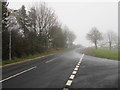
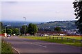
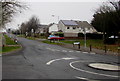
Woodside Road, Trevethin
A road at the northern edge of Trevethin, here about 275 metres (900 ft) above mean sea level.
Image: © Jaggery
Taken: 5 Dec 2016
0.22 miles