1
Electric vehicle recharging area, Trosnant Street Lower Car Park, Pontypool
On the left here https://www.geograph.org.uk/photo/6552024 viewed in July 2020.
Image: © Jaggery
Taken: 26 Jul 2020
0.01 miles
2
Trosnant Street Lower Car Park, Pontypool
Car park on the north side of Trosnant Street and the south bank of a river, the Afon Lwyd.
Free to use in July 2020, this is one of several car parks in this part of Pontypool.
Image: © Jaggery
Taken: 26 Jul 2020
0.01 miles
3
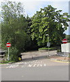
No Entry signs and trees on the south side of Trosnant Street, Pontypool
The signs are alongside the exit road from Trosnant Lodge Medical Practice.
Image: © Jaggery
Taken: 26 Jul 2020
0.02 miles
4
Thieves Beware notice, Trosnant Street, Pontypool
The notice warns would-be thieves that property in The Settlement (Pontypool Community Education Centre) is protected by SmartWater. SmartWater is a colourless liquid that can be applied to property such as jewellery, ornaments and electrical items. The contents of each bottle contain a unique chemical code which is registered to the user, positively proving ownership. SmartWater is almost impossible to remove and cannot easily be seen by the naked eye. It glows under ultraviolet light, aiding forensic investigation.
Image: © Jaggery
Taken: 26 Jul 2020
0.02 miles
5
Trosnant Lodge Medical Practice, Pontypool
Viewed from Trosnant Street. The main entrance https://www.geograph.org.uk/photo/6552158 is on the far side.
Image: © Jaggery
Taken: 26 Jul 2020
0.02 miles
6
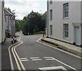
Trosnant Street traffic calming, Pontypool
Vehicles should stop behind the broken white lines to give way to oncoming vehicles.
Image: © Jaggery
Taken: 26 Jul 2020
0.02 miles
7
Masonic Hall, Trosnant Street, Pontypool
Large masonic symbols form part of the entrance gates.
Image: © Jaggery
Taken: 26 Jul 2020
0.02 miles
8
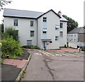
Trosnant House, Pontypool
Three-storey Melin Homes property viewed from Clarence Place Car Park in July 2020.
Image: © Jaggery
Taken: 26 Jul 2020
0.02 miles
9
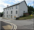
Three-storey building, Trosnant Street, Pontypool
Shown on maps as Torfaen People's Centre, though no name signs are in view in July 2020.
Image: © Jaggery
Taken: 26 Jul 2020
0.02 miles
10
Pontypool Brass Band premises
Located on Trosnant Street, next door to the Masonic Hall. http://www.geograph.org.uk/photo/2484306
Pontypool Brass Band was formed in 1967.
Image: © Jaggery
Taken: 30 Jun 2011
0.03 miles


