1
Upper section of Lock Up Lane, Abersychan
Lock Up Lane climbs towards the edge of woodland. The lower section http://www.geograph.org.uk/photo/2137773 was near the now demolished police station which opened in 1885.
Image: © Jaggery
Taken: 16 Apr 2011
0.03 miles
2
Cycle route information board at Pentwyn lane
Afon Lwyd Trail, NCR 492 on former railway, at exit to Pentwyn Lane; the railings, left, guard the underpass.
Image: © M J Roscoe
Taken: 25 Feb 2022
0.06 miles
3
Site of former Pentwyn Halt
Image: © Gareth James
Taken: 15 Oct 2011
0.07 miles
4
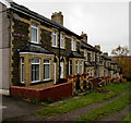
Severn View, Pentwyn, Torfaen
Row of houses between Pentwyn Road and Pentwyn Heights.
Image: © Jaggery
Taken: 6 Nov 2018
0.08 miles
5
Old Telephone Exchange, Abersychan
Located on High Street. There was no indication at the site as to this well-maintained building's current usage.
Image: © Jaggery
Taken: 12 May 2010
0.08 miles
6
Former Abersychan Library
Located on Brynteg, near the corner of High Street.
Abersychan Library closed down in April 2010 despite attempts by residents to save it. Campaigners handed in a 707-signature petition in a bid to stop Torfaen Borough Council axing the facility. Weight was added with an appeal from Torfaen’s MP Paul Murphy, but councillors voted to close it as part of measures to save around £114,000 from the leisure, libraries and arts service.
A mobile library service now operates in Abersychan.
Image: © Jaggery
Taken: 12 May 2010
0.08 miles
7
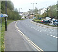
Union Street, Abersychan
Union Street (B4246) climbs away from the T-junction with Broad Street (A4043) past a free car park.
Image: © Jaggery
Taken: 16 Apr 2011
0.08 miles
8
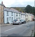
Pastel shades, High Street, Abersychan
Colourful houses on the north side of High Street. The gap in the houses is the turning for Brynteg. http://www.geograph.org.uk/photo/1858203
Image: © Jaggery
Taken: 16 Apr 2011
0.08 miles
9
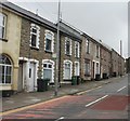
Houses, High Street, Abersychan
Houses on the south side of High Street, viewed from the corner of Brynteg.http://www.geograph.org.uk/photo/1858203
Image: © Jaggery
Taken: 12 May 2010
0.08 miles
10
Seat by NCN492 in Snatchwood
Image: © David Smith
Taken: 26 Sep 2021
0.08 miles


