1
Ordnance Survey Cut Mark
This OS cut mark can be found on the wall at the junction of Harpers Road and Viaduct Road. It marks a point 220.273m above mean sea level.
Image: © Adrian Dust
Taken: 25 Aug 2019
0.04 miles
2
Hair on Harpers, Abersychan
Unisex hair salon on Lower Harper's Road.
Image: © Jaggery
Taken: 25 Oct 2010
0.05 miles
3
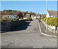
No pavements, Lower Harper's Road, Abersychan
There are no pavements alongside Lower Harper's Road in this section between Viaduct Road and Hillrise.
Image: © Jaggery
Taken: 25 Oct 2010
0.05 miles
4
South along Harper's Road from Garndiffaith towards Abersychan
Looking past the Lower Stoney Road junction on the left and the Stoney Road junction on the right.
Image: © Jaggery
Taken: 19 Jul 2018
0.05 miles
5
Eastern arm of Stoney Road, Victoria Village
Stoney Road climbs away from Viaduct Road. The western arm of Stoney Road is about 100 metres to the west, beyond the left edge of the photo. Victoria Village is a hamlet near Abersychan.
Image: © Jaggery
Taken: 25 Oct 2010
0.05 miles
6
Houses at the eastern end of Viaduct Road, Victoria Village
Houses near the crossroads of Viaduct Road, Vicarage Lane, Harper's Road and Lower Harper's Road.
Image: © Jaggery
Taken: 25 Oct 2010
0.05 miles
7
Hillrise, Abersychan
Houses on the north side of Hillrise viewed across Lower Harper's Road.
Image: © Jaggery
Taken: 25 Oct 2010
0.05 miles
8
Ordnance Survey Cut Mark
This OS cut mark can be found on No25 Harpers Road. It marks a point 213.473m above mean sea level.
Image: © Adrian Dust
Taken: 25 Aug 2019
0.06 miles
9
Ordnance Survey Rivet
This OS rivet can be found on the stone NW side of the road. It marks a point 242.002m above mean sea level.
Image: © Adrian Dust
Taken: 25 Aug 2019
0.09 miles
10
Rising Sun Inn, Abersychan
Pub on Cwmavon Road (A4043). A notice shows "Open all day. Open for food 12.00-2.30 6.30-9.30"
Image: © Jaggery
Taken: 28 Apr 2011
0.09 miles


