1
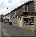
Mr Cheapies, Garndiffaith
Household & fancy goods shop at 62 Stanley Road.
The Little India takeaway name sign is on the left side of a metal shutter.
Image: © Jaggery
Taken: 16 Jul 2018
0.01 miles
2
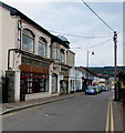
Stanley Road shops, Garndiffaith
Extending for 80 metres along the south side of Stanley Road.
Image: © Jaggery
Taken: 16 Jul 2018
0.01 miles
3
Bilingual street name sign in Garndiffaith
Empire Terrace is Teras yr Ymerodraeth in Welsh.
Image: © Jaggery
Taken: 16 Jul 2018
0.02 miles
4
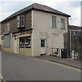
Nuha Curry, Stanley Road, Garndiffaith
Indian & Bangladeshi cuisine takeaway.
Image: © Jaggery
Taken: 16 Jul 2018
0.02 miles
5
Fenced-off area in Garndiffaith
A Site Safety notice is on the temporary fence on the north side of Stanley Road in July 2018.
Image: © Jaggery
Taken: 16 Jul 2018
0.02 miles
6
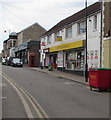
Garndiffaith Convenience Store, Stanley Road, Garndiffaith
In July 2018 the village post office is inside this Premier convenience store.
The building was formerly occupied by Garndiffaith Post Office.
Image: © Jaggery
Taken: 16 Jul 2018
0.02 miles
7
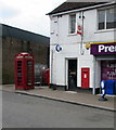
Red phonebox and postbox, Stanley Road, Garndiffaith
Originally outside the village post office which was in its own building.
In 2018, the building is now Garndiffaith Convenience Store https://www.geograph.org.uk/photo/5845840 inside which is a post office counter.
Image: © Jaggery
Taken: 16 Jul 2018
0.02 miles
8
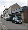
Garndiffaith Co-op
Supermarket viewed across Stanley Road Garndiffaith.
Image: © Jaggery
Taken: 16 Jul 2018
0.03 miles
9
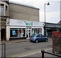
Well Pharmacy, Garndiffaith
Viewed across Stanley Road in July 2018.
A June 2011 Google Earth Street View shows a Co-operative Pharmacy here.
Image: © Jaggery
Taken: 16 Jul 2018
0.03 miles
10
Pillar of the Community, Garndiffaith
Located at the SW edge of the former Garndiffaith Elementary School. The site is now occupied by Garndiffaith Community Centre. https://www.geograph.org.uk/photo/5852891 An information board records that Pillar of the Community is the work of designer and sculptor Mark Folds. Working with ideas from local residents, organisations and scholars, Mark designed the sculpture to reflect the people, places and history that make Garndiffaith such a vibrant community.
Image: © Jaggery
Taken: 16 Jul 2018
0.04 miles


