IMAGES TAKEN NEAR TO
Brynteg, PONTYPOOL, NP4 7BG
Introduction
This page details the photographs taken nearby to Brynteg, NP4 7BG by members of the Geograph project.
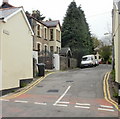
The Geograph project started in 2005 with the aim of publishing, organising and preserving representative images for every square kilometre of Great Britain, Ireland and the Isle of Man.

There are currently over 7.5m images from over14,400 individuals and you can help contribute to the project by visiting https://www.geograph.org.uk
Image Map
Images are licensed for reuse under creativecommons.org/licenses/by-sa/2.0
Notes
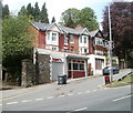
- Clicking on the map will re-center to the selected point.
- The higher the marker number, the further away the image location is from the centre of the postcode.
Image Listing (241 Images Found)
Images are licensed for reuse under creativecommons.org/licenses/by-sa/2.0
Image
Details
Distance
1
Brynteg, Abersychan
A short cul-de-sac, viewed from High Street.
Image: © Jaggery
Taken: 12 May 2010
0.02 miles
2
Houses on the south side of High Street, Abersychan
On the right here. https://www.geograph.org.uk/photo/5847327
Image: © Jaggery
Taken: 16 Jul 2018
0.03 miles
3
Blue direction sign alongside High Street, Abersychan
Showing Community Hall and Glansychan Park, the sign points towards
the street named Brynteg. http://www.geograph.org.uk/photo/1858203 The text on the sign is also in Welsh.
Image: © Jaggery
Taken: 16 Jul 2018
0.04 miles
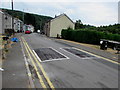
4
Down High Street, Abersychan
High Street descends towards Broad Street. This High Street is partly commercial, mainly residential.
Image: © Jaggery
Taken: 16 Jul 2018
0.04 miles
5
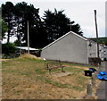
High Street bench, Abersychan
One of two benches in a grassy area on the north side of High Street.
Image: © Jaggery
Taken: 16 Jul 2018
0.04 miles
7
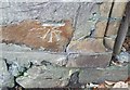
Ordnance Survey Cut Mark
This OS cut mark can be found on the wall SW side of Old Lane. It marks a point 193.252m above mean sea level.
Image: © Adrian Dust
Taken: 25 Aug 2019
0.05 miles
8
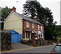
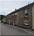
High Street semis, Abersychan
Semi-detached houses on the descent towards Broad Street.
Image: © Jaggery
Taken: 16 Jul 2018
0.05 miles
9
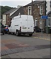
The Basement, Abersychan
Located at the junction of Ffrwd Road and Station Street (A4043). The business sells electrical toys and accessories.
Image: © Jaggery
Taken: 9 May 2011
0.06 miles
10
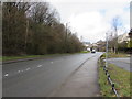
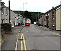
Up Union Street, Abersychan
The start of the long ascent of the B4246 from the centre of Abersychan at about 170 metres (c555 ft) above mean sea level to Blaenavon, the highest parts of which are about 400 metres (c1,300 ft) above mean sea level.
Image: © Jaggery
Taken: 15 Mar 2018
0.06 miles