IMAGES TAKEN NEAR TO
East View, High Street, PONTYPOOL, NP4 7BE
Introduction
This page details the photographs taken nearby to East View, High Street, NP4 7BE by members of the Geograph project.
The Geograph project started in 2005 with the aim of publishing, organising and preserving representative images for every square kilometre of Great Britain, Ireland and the Isle of Man.

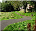
There are currently over 7.5m images from over14,400 individuals and you can help contribute to the project by visiting https://www.geograph.org.uk
Image Map
Images are licensed for reuse under creativecommons.org/licenses/by-sa/2.0
Notes
- Clicking on the map will re-center to the selected point.
- The higher the marker number, the further away the image location is from the centre of the postcode.
Image Listing (239 Images Found)
Images are licensed for reuse under creativecommons.org/licenses/by-sa/2.0
Image
Details
Distance
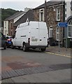
1
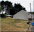
High Street bench, Abersychan
One of two benches in a grassy area on the north side of High Street.
Image: © Jaggery
Taken: 16 Jul 2018
0.02 miles
3
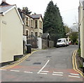
Brynteg, Abersychan
A short cul-de-sac, viewed from High Street.
Image: © Jaggery
Taken: 12 May 2010
0.04 miles
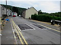
4
Houses on the south side of High Street, Abersychan
On the right here. https://www.geograph.org.uk/photo/5847327
Image: © Jaggery
Taken: 16 Jul 2018
0.05 miles
5
Benches in Glansychan Park, Abersychan
In the southwest corner of the park.
Image: © Jaggery
Taken: 29 Sep 2015
0.05 miles
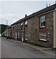
6
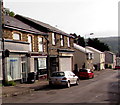
Troubleshooters and Abersychan Allsorts, High Street, Abersychan
Text in view in late September 2015 shows that Troubleshooters on the left provide services for business.
For Abersychan Allsorts next door the claim is "we buy & sell anything & everything". Hmm...
Image: © Jaggery
Taken: 29 Sep 2015
0.05 miles
7
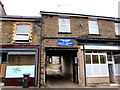
High Street Motors, Abersychan
Garage set back from the north side of High Street.
Image: © Jaggery
Taken: 16 Jul 2018
0.05 miles
8
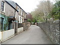
Glansychan Lane, Abersychan
Viewed from the corner of Lewis Street, Glansychan Lane heads towards Glansychan Park. The park's perimeter wall is on the right.
Image: © Jaggery
Taken: 16 Apr 2011
0.05 miles
9
Blue direction sign alongside High Street, Abersychan
Showing Community Hall and Glansychan Park, the sign points towards
the street named Brynteg. http://www.geograph.org.uk/photo/1858203 The text on the sign is also in Welsh.
Image: © Jaggery
Taken: 16 Jul 2018
0.05 miles
10
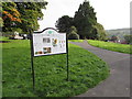
Information board in Glansychan Park, Abersychan
The board records that Glansychan Park was once the grounds of Glansychan House, the home of Thomas Lewis, a local draper and grocer. The house, built in the mid 18th century, stood close to this spot with a kitchen garden to the north. The right side of the board lists the birds in the park, including nuthatch, tree creeper, coaltit, goldfinch, greenfinch, bullfinch, siskin, tawny owl, green woodpecker and greater spotted woodpecker.
Image: © Jaggery
Taken: 29 Sep 2015
0.06 miles