1
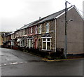
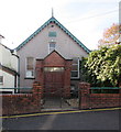
Poplar Terrace houses, Charlesville, Torfaen
On the right here https://www.geograph.org.uk/photo/5966443 viewed across Pentrepiod Road.
Image: © Jaggery
Taken: 6 Nov 2018
0.00 miles
2
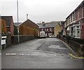
Road into Charlesville, Torfaen
From Pentrepiod Road. The sign on the left shows that the road ahead leads to
Grove Terrace, Park Terrace, Rochdale Terrace, Grove Estate.
Poplar Terrace houses https://www.geograph.org.uk/photo/5966431 are on the right.
Image: © Jaggery
Taken: 6 Nov 2018
0.01 miles
3
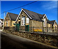
Zion Hill Community Centre, Pontnewynydd
Viewed across Pentrepiod Road. Zion Hill Community Centre is also known as Pontnewynydd Community Centre.
Image: © Jaggery
Taken: 2 Nov 2018
0.02 miles
4
On-street parking, Mount Pleasant Road, Pontnewynydd
Looking towards Pentrepiod Road.
Image: © Jaggery
Taken: 2 Nov 2018
0.02 miles
5
Information board on the wall of Pontnewynydd Community Centre
On the wall centre right here https://www.geograph.org.uk/photo/5962028 viewed in November 2018.
Pontnewynydd Community Centre is also known as Zion Hill Community Centre.
Image: © Jaggery
Taken: 2 Nov 2018
0.02 miles
6
Pontnewynydd Community Centre, Pentrepiod Road, Pontnewynydd
Pontnewynydd Community Centre is also known as Zion Hill Community Centre.
Image: © Jaggery
Taken: 2 Nov 2018
0.02 miles
7
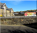
Slimming World banner on Pentrepiod Road railings, Pontnewynydd
Viewed in November 2018. The banner shows that Slimming World meets in Zion Hill Community Centre (on the left) every Wednesday at 5:30pm and 7:30pm. Zion Hill Community Centre is also known as Pontnewynydd Community Centre.
Image: © Jaggery
Taken: 2 Nov 2018
0.04 miles
8
Zion Hill Baptist Chapel, Mount Pleasant, Pontnewynydd
On the south side of Pentrepiod Road, this is the 1928
rebuild/extension of the original chapel erected in 1881. https://www.geograph.org.uk/photo/5962007
Image: © Jaggery
Taken: 2 Nov 2018
0.05 miles
9
Zion Hill Baptist Chapel 1881 plaque, Mount Pleasant, Pontnewynydd
On the wall here. https://www.geograph.org.uk/photo/5962004
Image: © Jaggery
Taken: 2 Nov 2018
0.05 miles
10
Pontnewynydd Community Centre, Pontypool
Located on Pentre-piod Road.
Image: © Jaggery
Taken: 26 May 2011
0.06 miles


