1
Ten letterboxes, Griffin Court, Osborne Road, Pontypool
The door is here. http://www.geograph.org.uk/photo/2394825 The postman needs to concentrate here - odd-numbered flats on the left,
lowest number at the top, even-numbered on the right, highest number at the top.
Image: © Jaggery
Taken: 2 Jan 2014
0.01 miles
2
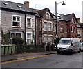
Osborne Road, Pontypool
Viewed from near the Malthouse Lane junction (on the right) looking towards Griffin Court. http://www.geograph.org.uk/photo/2394825
Image: © Jaggery
Taken: 2 Jan 2014
0.01 miles
3
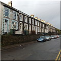
Long row of houses, Osborne Road, Pontypool
Looking NNW towards Pontnewynydd.
Image: © Jaggery
Taken: 2 Jan 2014
0.02 miles
4
Ordnance Survey Rivet
This OS rivet can be found on the wall of No74 Osborne Road. It marks a point 136.938m above mean sea level.
Image: © Adrian Dust
Taken: 7 Jul 2019
0.02 miles
5
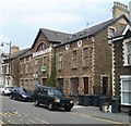
Griffin Court, Pontypool
The former Griffin Press building on Osborne Road has been converted to 15 flats.
Image: © Jaggery
Taken: 4 May 2011
0.03 miles
6
No longer a bus stop in Osborne Road, Pontypool
I had seen no buses in Osborne Road for the 30 minutes or so that I had been in the area, so I was surprised to see this bus stop pole with a sign on it showing several bus routes.
On closer inspection, I saw that there was a Stagecoach in South Wales customer information notice lower down the pole. It stated that from January 21st 2008, this bus stop is no longer in use. Buses operate via Riverside and Market Square instead. The bus stop pole is still here in early January 2014, nearly 6 years later...
Image: © Jaggery
Taken: 2 Jan 2014
0.03 miles
7
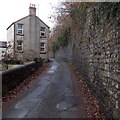
Northern end of Malthouse Lane, Pontypool
Malthouse Lane heads away from Osborne Road towards George Street. The stone wall on the right formerly supported a railway embankment. The railway has long gone, replaced by the A4043.
Image: © Jaggery
Taken: 2 Jan 2014
0.04 miles
8
Humps for 500 yards along Osborne Road, Pontypool
Viewed across the road name Riverside. The sign on the left shows
that there are humps in the road (to slow down vehicles) for 500 yards ahead.
Image: © Jaggery
Taken: 2 Jan 2014
0.04 miles
9
Electricity substation on the corner of Osborne Road and Malthouse Lane, Pontypool
Step lead up to the substation from Osborne Road. Someone - or something - has caused the triangular traffic sign to rotate so that it now faces the substation.
Image: © Jaggery
Taken: 2 Jan 2014
0.05 miles
10
Shared path by A4043 in Pontypool
Image: © David Smith
Taken: 26 Sep 2021
0.07 miles


