1
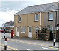
Three storey flats, East View, Pontypool
Viewed across an open space on the north side of High Street.
Image: © Jaggery
Taken: 16 May 2011
0.08 miles
2
Padre Pio RC primary school, Pontypool
Located on the south side of Conway Road. The school is named after Saint Pio of Pietrelcina (1887– 1968), an Italian Capuchin priest who was canonised by Pope John Paul II in 2002.
The school opened in September 2008, with a transfer of pupils from the now-closed Catholic primary schools of St Alban and St Francis. The £3½ million project was financed jointly by the Roman Catholic Archdiocese of Cardiff, the Welsh Assembly Government and Torfaen Council.
The school has many modern features such as interactive whiteboards in every classroom and a high definition video conferencing unit. There is an outdoor sports playing field, a facility absent from the two previous schools. Environmentally 'green' features include the collection of rain water to flush toilets and a biomass boiler to heat the building.
Image: © Jaggery
Taken: 16 May 2011
0.10 miles
3
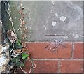
Ordnance Survey Cut Mark
This OS cut mark can be found on No14 South View. It marks a point 175.358m above mean sea level.
Image: © Adrian Dust
Taken: 7 Jul 2019
0.11 miles
4
King Street, Pontypool
Viewed across Conway Road.
Image: © Jaggery
Taken: 23 Sep 2011
0.11 miles
5
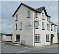
Ordnance Survey Cut Mark
This OS cut mark can be found on the Labour in Vain PH. It marks a point 187.382m above mean sea level.
Image: © Adrian Dust
Taken: 7 Jul 2019
0.12 miles
6
Wern Terrace, High Street, Pontypool
This row of houses on the south side of High Street is named Wern Terrace. The houses are numbered separately from surrounding houses on High Street.
Image: © Jaggery
Taken: 16 May 2011
0.13 miles
7
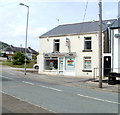
Former post office, High Street, Pontypool
The postbox is the only remaining clue that this was formerly the High Street post office, which closed down in 2003. The main post office in Pontypool is in Osborne Road, http://www.geograph.org.uk/photo/2393356 in the central shopping area of the town.
Image: © Jaggery
Taken: 16 May 2011
0.13 miles
8
High Street Spar, Pontypool
Located on the corner of High Street and North Road, opposite Jewel Balti. http://www.geograph.org.uk/photo/2417203
Image: © Jaggery
Taken: 16 May 2011
0.13 miles
9
Jewel Balti, Pontypool
Restaurant on the corner of High Street and North Road, formerly the Forgehammer pub.
Image: © Jaggery
Taken: 16 May 2011
0.14 miles
10
The Chippy, High Street, Pontypool
Takeaway for fish & chips, roast chicken, hot dogs and burgers.
Out of shot on the right, its neighbour was formerly the Colliers Arms pub, now closed.
Image: © Jaggery
Taken: 16 May 2011
0.14 miles


