1
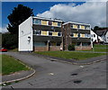
Children's play area in Sebastopol, Pontypool
Located between Sherbourne Road on this side and Wern Road ahead.
Image: © Jaggery
Taken: 9 Aug 2014
0.01 miles
2
Monmouthshire and Brecon Canal near Sebastopol
Houses reflected in the Monmouthshire and Brecon Canal near Sebastopol.
Image: © Philip Halling
Taken: 12 Apr 2013
0.02 miles
3
Monmouthshire and Brecon Canal passing houses in Wern Road
The houses in Wern Road have long front gardens and back onto the canal and the canal path
Image: © David Smith
Taken: 26 Sep 2021
0.02 miles
4
St Oswald's Church, Pontypool
Located in Wern Road, Sebastopol, part of the Church in Wales Parish of Griffithstown in the Diocese of Monmouth. The daughter church of St Hilda's, http://www.geograph.org.uk/photo/1577404 St Oswald's occupies a red brick building that was originally an infants school. It became surplus to the requirements of Monmouthshire County Council in the early 1900s. After a twelve month conversion, the church was dedicated on March 29th 1915.
Image: © Jaggery
Taken: 9 Aug 2014
0.02 miles
5
Wern Road electricity substation, Pontypool
The dark green metal box is located in a corner of a children's playground. The identifier on
the Western Power Distribution electricity substation is WERN RD. PANTEG S/S No. 531479.
Image: © Jaggery
Taken: 9 Aug 2014
0.02 miles
6
Canal reflections
A house reflected in the still waters of the Monmouthshire and Brecon Canal near Sebastopol.
Image: © Philip Halling
Taken: 12 Apr 2013
0.03 miles
7
St Oswald’s Church
Image: © Alan Hughes
Taken: 29 Oct 2023
0.03 miles
8
3-storey block of flats in School Crescent, Sebastopol, Pontypool
At the northern end of School Crescent, near the Wern Road junction.
Image: © Jaggery
Taken: 9 Aug 2014
0.03 miles
9
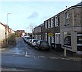
Wern Road, Sebastopol, Pontypool
Viewed across South Street. Sweeneys http://www.geograph.org.uk/photo/4321838 is on the right.
Image: © Jaggery
Taken: 24 Jan 2015
0.03 miles
10
Sherbourne Road Senior Citizens Club, Sebastopol, Pontypool
Located at the northern end of Sherbourne Road, near Sherbourne Court. http://www.geograph.org.uk/photo/4111123
Image: © Jaggery
Taken: 9 Aug 2014
0.05 miles


