IMAGES TAKEN NEAR TO
Langstone Court, CWMBRAN, NP44 7JZ
Introduction
This page details the photographs taken nearby to Langstone Court, NP44 7JZ by members of the Geograph project.
The Geograph project started in 2005 with the aim of publishing, organising and preserving representative images for every square kilometre of Great Britain, Ireland and the Isle of Man.

There are currently over 7.5m images from over14,400 individuals and you can help contribute to the project by visiting https://www.geograph.org.uk
Image Map
Images are licensed for reuse under creativecommons.org/licenses/by-sa/2.0
Notes
- Clicking on the map will re-center to the selected point.
- The higher the marker number, the further away the image location is from the centre of the postcode.
Image Listing (107 Images Found)
Images are licensed for reuse under creativecommons.org/licenses/by-sa/2.0
Image
Details
Distance
1
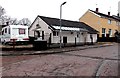
Langstone Court, Cwmbran
Langstone Court is a short residential cul-de-sac on the south side of Waun Road.
Image: © Jaggery
Taken: 9 Mar 2013
0.01 miles
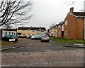
2
Langstone Court in Cwmbran
Short cul-de-sac on the south side of Waun Road. Lockup garages are on the left.
Image: © Jaggery
Taken: 24 Mar 2018
0.01 miles
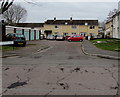
3
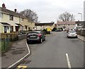
From Waun Road to Nolton Place, Cwmbran
The Waun Road name sign is on the wall above the red car.
The Nolton Place name sign is on the wall beyond the gap between houses.
Image: © Jaggery
Taken: 24 Mar 2018
0.03 miles
4
Sleeping policemen, Waun Road, Cwmbran
Designed to reduce the speed at which vehicles traverse the road, these additions to the road surface are known variously as speed humps, speed bumps or sleeping policemen.
Image: © Jaggery
Taken: 9 Mar 2013
0.04 miles
5
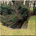
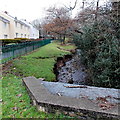
Dowlais Brook flows away from Waun Road, Cwmbran
The brook is a tributary of the Afon Lwyd.
Image: © Jaggery
Taken: 9 Mar 2013
0.04 miles
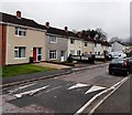
6
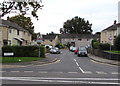
South along Waun Road, Cwmbran
From Henllys Way along Waun Road towards the Nolton Place junction.
Image: © Jaggery
Taken: 24 Mar 2018
0.04 miles
7
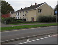
Presteigne Walk, St. Dials, Cwmbran
Houses on the south side of Henllys Way viewed from the corner of Blenheim Road.
Image: © Jaggery
Taken: 20 Oct 2016
0.04 miles
8
Waun Road, St Dials, Cwmbran
On the south side of Henllys Way. The road sign shows Humps for 600 yards.
The bilingual name sign on the left shows that Waun Road is Ffordd Gwaun in Welsh.
Image: © Jaggery
Taken: 20 Oct 2016
0.05 miles
9
Dowlais Brook flows towards Waun Road, Cwmbran
The brook is a tributary of the Afon Lwyd.
Image: © Jaggery
Taken: 9 Mar 2013
0.06 miles
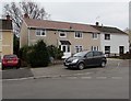
10
SW end of Waun Road, Cwmbran
Waun Road here bends from heading westwards to heading NNW, towards Henllys Road.
The bungalow is on the corner of Nolton Place, out of shot on the left.
Image: © Jaggery
Taken: 9 Mar 2013
0.06 miles