1
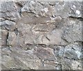
Ordnance Survey Cut Mark
This OS cut mark can be found on No9 New Row. It marks a point 213.924m above mean sea level.
Image: © Adrian Dust
Taken: 17 Aug 2020
0.01 miles
2
Old Row, Henllys, Cwmbran
A row of six houses built c1830 on the west side of The Incline, a former tramway. http://www.geograph.org.uk/photo/2604568
Image: © Jaggery
Taken: 16 Sep 2011
0.07 miles
3
Mount Pleasant Baptist Chapel, Cwmbran
Located alongside The Incline. http://www.geograph.org.uk/photo/2604568
Inscribed in stone on the chapel is the name of the chapel and BUILT 1876. The pebbledashed wall of the single-storey structure on the left side of the chapel (perhaps a church hall) strikes a jarring contrast with the plain stones of the chapel.
Image: © Jaggery
Taken: 16 Sep 2011
0.08 miles
4
Ordnance Survey Cut Mark
This OS cut mark can be found on No 2 Four Houses. It marks a point 193.749m above mean sea level.
Image: © Adrian Dust
Taken: 17 Aug 2020
0.08 miles
5
Mount Pleasant Chapel, Henllys, Cwmbran
Image: © Matt Rosser
Taken: 9 Apr 2008
0.10 miles
6
Ordnance Survey Cut Mark
This OS cut mark can be found on the SW face of Mount Pleasant Chapel. It marks a point 229.819m above mean sea level.
Image: © Adrian Dust
Taken: 17 Aug 2020
0.10 miles
7
Track to Pen-y-wyrlod Farm, Cwmbran
Viewed from Henllys. The track leads to farm buildings around which houses in Ty Canol have been built (Buttercup Court and Hawkes Ridge).
Image: © Jaggery
Taken: 16 Sep 2011
0.10 miles
8
Southeast end of Buttercup Court, Ty Canol, Cwmbran
Buttercup Court ascends from grass at the edge of a footpath from Incline Lane to Heather Court.
Image: © Jaggery
Taken: 30 May 2016
0.14 miles
9
Tree-lined ascent towards Craig Llywarch Farm, Henllys
Viewed from near Mount Pleasant Baptist Chapel. http://www.geograph.org.uk/photo/2604707 The road ascends towards Craig Llywarch Farm, http://www.geograph.org.uk/photo/90962 about 400 metres away.
Image: © Jaggery
Taken: 16 Sep 2011
0.15 miles
10
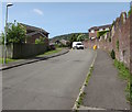
Up Buttercup Court, Ty Canol, Cwmbran
Past a long brick wall on the right, Buttercup Court ascends away from Heather Court.
Two yellow grit boxes are in the background, one each side of the van.
Image: © Jaggery
Taken: 30 May 2016
0.16 miles


