1
Blaen-y-cwm View, Henllys, Cwmbran
Cul-de-sac on the east side of Dorallt Way.
Image: © Jaggery
Taken: 30 May 2016
0.04 miles
2
The Incline, Cwmbran
Viewed from near Henllys Way. The ascending footpath is part of what was once The Incline, a tramway which ran from the Monmouthshire & Brecon canal near brickworks for about two miles to Henllys Colliery, an ascent of more than 600 feet (nearly 200 metres). This usage is recorded in the name of Tramway Close behind the camera.
Image: © Jaggery
Taken: 16 Sep 2011
0.04 miles
3
Field opposite Ashleigh Court, Cwmbran
Viewed across Henllys Way from near the junction for Ashleigh Court.
The black-on-white notice on the left states
LAND & PROPERTY OF TORFAEN BOROUGH COUNCIL
The white-on-red notice next to it states
DO NOT FEED THE HORSES. "NOT" is underlined.
Image: © Jaggery
Taken: 7 Jan 2012
0.04 miles
4
Blaen y Cwm View
Rainclouds in Henllys.
Image: © Burgess Von Thunen
Taken: 8 May 2012
0.04 miles
5
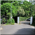
Public footpath between two gates, Incline Lane, Henllys, Cwmbran
The name on the gate on the right is MACHINE COTTAGE.
The red and white notice at the edge of the footpath shows NO HORSES and its Welsh equivalent.
Image: © Jaggery
Taken: 30 May 2016
0.06 miles
6
Belle Vue Terrace, Henllys
Image: © Matt Rosser
Taken: 9 Apr 2008
0.06 miles
7
Warning signs facing Dorallt Way, Henllys, Cwmbran
Signs warn of a narrowing road and no footway for 500 yards ahead.
Just out of shot on the left of the signs, a large street names sign http://www.geograph.org.uk/photo/5395069
shows that the road ahead leads to Old Row, New Row, Incline Lane,
Four Houses, Blaen-y-cwm View and Belle View Terrace.
Image: © Jaggery
Taken: 30 May 2016
0.06 miles
8
Yellow amid green, Henllys, Cwmbran
A yellow salt and grit bin is in a hedge between Incline Lane and Blaen-y-cwm View.
Image: © Jaggery
Taken: 30 May 2016
0.06 miles
9
Bend in Dorallt Way, Henllys, Cwmbran
Towards Henllys Village Road.
Image: © Jaggery
Taken: 30 May 2016
0.07 miles
10
Henllys Church in Wales Primary School, Cwmbran
Viewed across Henllys Way. The school opened in 1991. There were about 210 pupils (aged 4-11) enrolled in September 2011.
Image: © Jaggery
Taken: 7 Jan 2012
0.07 miles


