1
Ordnance Survey Cut Mark
This OS cut mark can be found on No31 Bagley Court. It marks a point 163.170m above mean sea level.
Image: © Adrian Dust
Taken: 17 Aug 2020
0.03 miles
2
Steps up to Bagley Court, Thornhill, Cwmbran
Ascending from Hafren Road.
Image: © Jaggery
Taken: 6 Apr 2017
0.04 miles
3
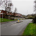
Pedestrian refuge in Thornhill Road, Upper Cwmbran
When Thornhill Road is busy with traffic, the refuge lets walkers cross half the road width at a time.
Image: © Jaggery
Taken: 29 Mar 2017
0.04 miles
4
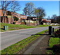
Junction of Hafren Road and Thornhill Road, Upper Cwmbran
Viewed across Hafren Road. This is one of two Hafren Road/Thornhill Road junctions in Cwmbran.
The other one is 400 metres to the south. http://www.geograph.org.uk/photo/5328543
Image: © Jaggery
Taken: 6 Apr 2017
0.05 miles
5
Northeast end of Hafren Road, Upper Cwmbran
Hafren Road ascends from Thornhill Road.
This is one of two Hafren Road/Thornhill Road junctions in Cwmbran.
The other one is 400 metres to the south. http://www.geograph.org.uk/photo/5329624
Image: © Jaggery
Taken: 29 Mar 2017
0.05 miles
6
Bagley Court, Thornhill, Cwmbran
Cul-de-sac above Hafren Road.
Image: © Jaggery
Taken: 6 Apr 2017
0.07 miles
7
Junction of Marl Court and Hafren Road, Thornhill, Cwmbran
Marl Court from the right joins Hafren Road.
Image: © Jaggery
Taken: 6 Apr 2017
0.07 miles
8
Hafren Road telecoms cabinets, Thornhill, Cwmbran
Alongside Hafren Road between the Marl Court junction and the Bagley Court junction.
Image: © Jaggery
Taken: 6 Apr 2017
0.07 miles
9
Path through an Upper Cwmbran field
From Cedar Walk to Aran Court.
Image: © Jaggery
Taken: 29 Mar 2017
0.07 miles
10
Marl Court, Thornhill, Cwmbran
Cul-de-sac viewed from the corner of Hafren Road.
Image: © Jaggery
Taken: 6 Apr 2017
0.07 miles


