1
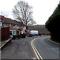
Along Maendy Way towards The Birches, Cwmbran
Viewed from the southern end of Bryn Celyn Road
looking along Maendy Way towards houses in The Birches.
Image: © Jaggery
Taken: 9 Apr 2014
0.05 miles
2
The Leas, Cwmbran
Viewed across Bryn Celyn Road.
Image: © Jaggery
Taken: 9 Apr 2014
0.09 miles
3
Maendy Wood Rise, West Pontnewydd, Cwmbran
From the corner of Heol y Pwca along Maendy Wood Rise towards Maendy Way.
Image: © Jaggery
Taken: 29 Mar 2017
0.10 miles
4
Channel View, West Pontnewydd, Cwmbran
From Maendy Way, Channel View leads to Adit Walk and Greenwood Avenue.
Image: © Jaggery
Taken: 29 Mar 2017
0.11 miles
5
The Yew Tree boarded up and fenced off, Cwmbran
A former pub on the corner of Maendy Way and Maendy Wood Rise, viewed in April 2014.
Image: © Jaggery
Taken: 9 Apr 2014
0.11 miles
6
Fenced off former Yew Tree pub, West Pontnewydd, Cwmbran
Former pub on the corner of Maendy Way and Maendy Wood Rise, viewed in March 2017.
The pub closed down in January 2013. http://www.geograph.org.uk/photo/5328902 to the name sign.
Image: © Jaggery
Taken: 29 Mar 2017
0.11 miles
7
Maendy Square Health Clinic, Cwmbran
On the corner of Maendy Wood Rise and Heol-y-Pwca.
Image: © Jaggery
Taken: 9 Apr 2014
0.11 miles
8
Ordnance Survey Cut Mark
This OS cut mark can be found on No143 Maendy Way. It marks a point 110.990m above mean sea level.
Image: © Adrian Dust
Taken: 17 Aug 2020
0.12 miles
9
Yew Tree name sign, West Pontnewydd, Cwmbran
On the side of this http://www.geograph.org.uk/photo/5328896 derelict former pub.
Image: © Jaggery
Taken: 29 Mar 2017
0.12 miles
10
Houses on the east side of a bend in Bryn Celyn Road, Cwmbran
The houses are between The Leas http://www.geograph.org.uk/photo/3923992 behind the camera and Coed Cae ahead.
Image: © Jaggery
Taken: 9 Apr 2014
0.12 miles


