1
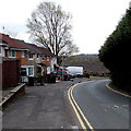
Along Maendy Way towards The Birches, Cwmbran
Viewed from the southern end of Bryn Celyn Road
looking along Maendy Way towards houses in The Birches.
Image: © Jaggery
Taken: 9 Apr 2014
0.03 miles
2
The Leas, Cwmbran
Viewed across Bryn Celyn Road.
Image: © Jaggery
Taken: 9 Apr 2014
0.05 miles
3
Houses on the east side of a bend in Bryn Celyn Road, Cwmbran
The houses are between The Leas http://www.geograph.org.uk/photo/3923992 behind the camera and Coed Cae ahead.
Image: © Jaggery
Taken: 9 Apr 2014
0.09 miles
4
Houses in The Rise, West Pontnewydd, Cwmbran
Viewed from the corner of Maendy Wood Rise.
Image: © Jaggery
Taken: 9 Apr 2014
0.10 miles
5
Ordnance Survey Cut Mark
This OS cut mark can be found on No143 Maendy Way. It marks a point 110.990m above mean sea level.
Image: © Adrian Dust
Taken: 17 Aug 2020
0.10 miles
6
Houses alongside a Maendy Wood Rise green, Cwmbran
The houses on the right are in Maendy Wood Rise. The houses behind them are in The Rise.
Image: © Jaggery
Taken: 9 Apr 2014
0.10 miles
7
Maendy Wood Rise, West Pontnewydd, Cwmbran
From the corner of Heol y Pwca along Maendy Wood Rise towards Maendy Way.
Image: © Jaggery
Taken: 29 Mar 2017
0.10 miles
8
Disused postbox in a brick column in West Pontnewydd Cwmbran
The box http://www.geograph.org.uk/photo/3923981 is sealed and looks long disused. The location is the corner of Bryn Celyn Road and the entrance road to Pontnewydd Primary School.
Image: © Jaggery
Taken: 9 Apr 2014
0.10 miles
9
Sealed-up former postbox in West Pontnewydd Cwmbran
Viewed in April 2014. Located http://www.geograph.org.uk/photo/3923984 on the corner of Bryn Celyn Road
and the entrance road to Pontnewydd Primary School. A Google Earth
Street View taken in August 2008 shows the box unsealed and in use,
with a collection times notice where the rusty rectangle is now.
Image: © Jaggery
Taken: 9 Apr 2014
0.10 miles
10
Nonconformity in West Pontnewydd, Cwmbran
5 Bryn Celyn Road lockup garages, 5 colours, 5 designs.
Image: © Jaggery
Taken: 9 Apr 2014
0.10 miles


