IMAGES TAKEN NEAR TO
Beechleigh Close, CWMBRAN, NP44 5EF

Introduction

This page details the photographs taken nearby to Beechleigh Close, NP44 5EF by members of the Geograph project.

The Geograph project started in 2005 with the aim of publishing, organising and preserving representative images for every square kilometre of Great Britain, Ireland and the Isle of Man.

There are currently over 7.5m images from over14,400 individuals and you can help contribute to the project by visiting https://www.geograph.org.uk

Image Map


Images are licensed for reuse under creativecommons.org/licenses/by-sa/2.0
Notes
  • Clicking on the map will re-center to the selected point.
  • The higher the marker number, the further away the image location is from the centre of the postcode.

Image Listing (20 Images Found)

Images are licensed for reuse under creativecommons.org/licenses/by-sa/2.0
Image
Details
Distance
1
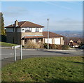
Residential area of Cwmbran
Image: © Colin Madge Taken: 16 Nov 2008
0.03 miles
2
Beechleigh Close, Cwmbran
Viewed across Penmaes Road. There are 44 houses in the Close, built c1985.
Image: © Jaggery Taken: 30 Jan 2011
0.06 miles
3
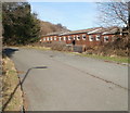
Western edge of Oaklands View, Cwmbran
Viewed from Penmaes Road.
Image: © Jaggery Taken: 30 Jan 2011
0.06 miles
4
Road junction in Cwmbran
Image: © Colin Madge Taken: 16 Nov 2008
0.09 miles
5
Dowlais Brook, Penmaes Road, Cwmbran
Dowlais Brook flows SE under Penmaes Road, between Rosemead and Beechleigh Close. Its course ends several kilometres to SE, at its confluence with the Afon Lwyd.
Image: © Jaggery Taken: 30 Jan 2011
0.11 miles
6
Rosemead, Cwmbran
Located at the western edge of residential Cwmbran, Rosemead is a road of about 60 houses, built in 1998. Viewed from Penmaes Road.
Image: © Jaggery Taken: 30 Jan 2011
0.15 miles
7
Say it with boulders, Graig Road, Cwmbran
A sign stating 'No vehicles beyond this point' is not needed here - boulders are better, as they cannot be ignored.
Image: © Jaggery Taken: 30 Jan 2011
0.16 miles
8
Monnow Court houses, Cwmbran
Viewed across Graig Road.
Image: © Jaggery Taken: 30 Jan 2011
0.16 miles
9
Wellington Drive, Greenmeadow, Cwmbran
Houses on the west side of Wellington Drive, viewed from Marlborough Road.
Image: © Jaggery Taken: 30 Jan 2011
0.16 miles
10
Norfolk Close, Greenmeadow, Cwmbran
Viewed from Marlborough Road.
Image: © Jaggery Taken: 30 Jan 2011
0.16 miles