1
Units 93-95, Springvale Industrial Estate, Cwmbran
In increasing distance from the camera are:
Unit 93, Phil James Upholstery.
Unit 94, Crossford Oil & Tool Supplies.
Unit 95, Gwent Wholesale Ltd (trade only).
Image: © Jaggery
Taken: 30 Jan 2011
0.09 miles
2
Colley Motors, Cwmbran
Car sales business and Texaco filling station viewed across Maendy Way.
Image: © Jaggery
Taken: 9 Apr 2014
0.15 miles
3
Maendy Way leading to industrial buildings
Image: © David Smith
Taken: 29 Sep 2021
0.15 miles
4
Traffic calming on Maendy Way opposite Colley Motors, Cwmbran
This is one of several roadway narrowings designed to slow down traffic along Maendy Way.
Image: © Jaggery
Taken: 9 Apr 2014
0.15 miles
5
Fike, Springvale Industrial Estate, Cwmbran
Occupying unit 31, Fike Safety Technology's product range includes intelligent smoke detectors, sounders, manual call points and control panels.
Image: © Jaggery
Taken: 30 Jan 2011
0.16 miles
6
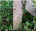
Ordnance Survey Cut Mark
This OS cut mark can be found on a concrete post south side of Maendy Way. It marks a point 95.570m above mean sea level.
Image: © Adrian Dust
Taken: 17 Aug 2020
0.16 miles
7
Bus stop in woodland, Cwmbran
This part of Maendy Way is through Church Wood. The bus stop is opposite Trinity Road. http://www.geograph.org.uk/photo/3926438
Image: © Jaggery
Taken: 9 Apr 2014
0.16 miles
8
Footpath between Greenforge Way and Springvale Industrial Estate, Cwmbran
There is no roadside pavement on the north side of Greenforge Way in this area. Instead, pedestrians use this path, a few metres from the roadway.
Image: © Jaggery
Taken: 30 Jan 2011
0.17 miles
9
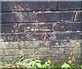
Ordnance Survey Cut Mark
This OS cut mark can be found on the wall of No10 Green Forge Way. It marks a point 85.960m above mean sea level.
Image: © Adrian Dust
Taken: 17 Aug 2020
0.17 miles
10
Footpath and cycleway on the north side of Maendy Way, Cwmbran
Opposite Colley Motors. http://www.geograph.org.uk/photo/3926408
Image: © Jaggery
Taken: 9 Apr 2014
0.18 miles


