1
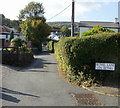
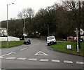
Bethel Lane, Upper Cwmbran
From Upper Cwmbran Road.
Image: © Jaggery
Taken: 17 Oct 2009
0.03 miles
2
The Queen Inn, Upper Cwmbran
Located on Upper Cwmbran Road.
Which queen is the young woman shown on the inn sign? http://www.geograph.org.uk/photo/3239756
Based on the age of a few nearby properties, and a similar hairstyle in some of her early portraits, my guess is the young Queen Victoria, circa 1845. But that's only a guess...
Image: © Jaggery
Taken: 17 Oct 2009
0.04 miles
3
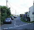
Tram Road, Upper Cwmbran
Looking along Tram Road from the corner of Graig Road.
Image: © Jaggery
Taken: 17 Oct 2009
0.05 miles
4
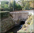
Blaen Bran flows under Upper Cwmbran Road, Cwmbran
The brook Blaen Bran is a small tributary of the Afon Lwyd.
Here, it flows towards the camera and this channel http://www.geograph.org.uk/photo/3239781 at the edge of The Queen Inn.
Image: © Jaggery
Taken: 8 Oct 2011
0.05 miles
5
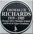
Black plaque commemorating an Olympic silver medallist, Upper Cwmbran
The plaque is on the outside wall of The Queen Inn. http://www.geograph.org.uk/photo/1612705 Tom Richards won a silver medal for Great Britain in the Marathon at the 1948 Summer Olympics in London.
Image: © Jaggery
Taken: 8 Oct 2011
0.06 miles
6
Name sign, The Queen Inn, Upper Cwmbran
Hanging from a bracket on a post at the roadside perimeter hedge here. http://www.geograph.org.uk/photo/1612705
Image: © Jaggery
Taken: 8 Oct 2011
0.06 miles
7
Ducks in the Blaen Bran, Upper Cwmbran
The brook Blaen Bran is a small tributary of the Afon Lwyd.
Here it flows along a channel towards a weir in front of The Queen Inn. http://www.geograph.org.uk/photo/1612705
Image: © Jaggery
Taken: 8 Oct 2011
0.06 miles
8
Upper Cwmbran Road, Upper Cwmbran
Looking to the northwest along Upper Cwmbran Road from the Thornhill Road junction.
Image: © Jaggery
Taken: 29 Mar 2017
0.08 miles
9
Upper Cwmbran Road
Upper Cwmbran Road, from the lower right of the photo, here makes a right turn. The road continuing on the left is Thornhill Road.
Image: © Jaggery
Taken: 17 Oct 2009
0.08 miles
10
Graig Vue Hall, Upper Cwmbran
Graig Vue (so spelt) Hall is located on Tram Road, close to Graig View http://www.geograph.org.uk/photo/1639523. Meeting place for Upper Cwmbran Old Age Pensioners Club.
Image: © Jaggery
Taken: 17 Oct 2009
0.09 miles


