1
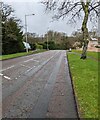
NW along Penylan Way, Cwmbran
In the Coed Eva area of Cwmbran.
Image: © Jaggery
Taken: 13 Mar 2022
0.07 miles
2
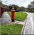
Queen Elizabeth II pillar box, Penylan Way, Cwmbran
In March 2022 a Spring-themed hat https://www.geograph.org.uk/photo/7117964 is on top of the pillar box in the Coed Eva area of Cwmbran.
Image: © Jaggery
Taken: 13 Mar 2022
0.09 miles
3
Spring-themed hat on a pillar box, Coed Eva, Cwmbran
Viewed on March 13th 2022. The pillar box is alongside Penylan Way opposite the Glan Rhyd junction.
Image: © Jaggery
Taken: 13 Mar 2022
0.09 miles
4
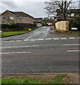
Junction of Penylan Way and Glan Rhyd, Cwmbran
Viewed across Penylan Way in the Coed Eva area of Cwmbran. The sign on left shows that Glan Rhyd is not a through route for motor vehicles.
Image: © Jaggery
Taken: 13 Mar 2022
0.10 miles
5
The Incline below Penylan Way
Cycle and pedestrian path on the site of a former tramway down from Henllys Colliery.
Image: © M J Roscoe
Taken: 21 Jul 2021
0.11 miles
6
Glan Rhyd, Coed Eva, Cwmbran
Looking to the SSW across Penylan Way towards the road named Glan Rhyd.
Image: © Jaggery
Taken: 13 Mar 2022
0.12 miles
7
Ordnance Survey Cut Mark
This OS cut mark can be found on No87 Farlays. It marks a point 111.120m above mean sea level.
Image: © Adrian Dust
Taken: 10 Sep 2020
0.12 miles
8
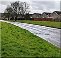
Grassy banks above Penylan Way, Cwmbran
Looking to the ESE along Penylan Way in the Coed Eva area of Cwmbran.
The houses are in the cul-de-sac named Glan Rhyd.
Image: © Jaggery
Taken: 13 Mar 2022
0.13 miles
9
Sports pitches, Penylan Way, Cwmbran
Cwmbran Town Football Club ground.
Image: © M J Roscoe
Taken: 21 Jul 2021
0.13 miles
10
Ordnance Survey Cut Mark
This OS cut mark can be found on the wall of No12 Glan Rhyd. It marks a point 96.960m above mean sea level.
Image: © Adrian Dust
Taken: 10 Sep 2020
0.17 miles


