IMAGES TAKEN NEAR TO
Trevine Path, CWMBRAN, NP44 4QH
Introduction
This page details the photographs taken nearby to Trevine Path, NP44 4QH by members of the Geograph project.
The Geograph project started in 2005 with the aim of publishing, organising and preserving representative images for every square kilometre of Great Britain, Ireland and the Isle of Man.

There are currently over 7.5m images from over14,400 individuals and you can help contribute to the project by visiting https://www.geograph.org.uk
Image Map
Images are licensed for reuse under creativecommons.org/licenses/by-sa/2.0
Notes
- Clicking on the map will re-center to the selected point.
- The higher the marker number, the further away the image location is from the centre of the postcode.
Image Listing (89 Images Found)
Images are licensed for reuse under creativecommons.org/licenses/by-sa/2.0
Image
Details
Distance
1
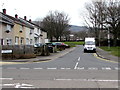
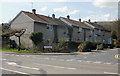
Windsor Road, Fairwater, Cwmbran
The southeast end of Windsor Road viewed across Henllys Way.
Image: © Jaggery
Taken: 24 Mar 2018
0.05 miles
3
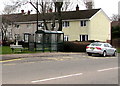
Bus shelter, BT phonebox and bench, Henllys Way, Cwmbran
The bus stop alongside the shelter is for buses to Cwmbran bus station.
Image: © Jaggery
Taken: 24 Mar 2018
0.07 miles
4
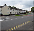
Henllys Way houses, St Dials, Cwmbran
Between Waun Road and Windsor Road.
Image: © Jaggery
Taken: 20 Oct 2016
0.09 miles
5
Windsor Road houses, Cwmbran
Houses on the west side of Windsor Road, viewed from Henllys Way.
Image: © Jaggery
Taken: 8 Apr 2010
0.09 miles
6
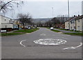
Henllys Way mini-roundabout opposite Fairwater Way, Cwmbran
Opposite the eastern end of Fairwater Way.
Image: © Jaggery
Taken: 24 Mar 2018
0.09 miles
7
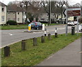
Henllys Way direction and distances sign, Cwmbran
The sign alongside Henllys Way shows turn left into Fairwater Way https://www.geograph.org.uk/photo/5716938 for the Ty Canol
area of Cwmbran (1 mile) and Fairwater Leisure Centre (three-quarters of a mile).
Image: © Jaggery
Taken: 24 Mar 2018
0.10 miles
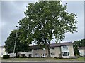
8
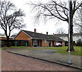
Nolton Place bungalows, Cwmbran
Nolton Place is a cul-de-sac at the west end of Waun Road.
Image: © Jaggery
Taken: 9 Mar 2013
0.10 miles
9
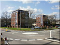
Blenheim Court, St Dials, Cwmbran
Flats on the corner of Blenheim Road and Henllys Way.
Image: © Jaggery
Taken: 8 Apr 2010
0.10 miles
10
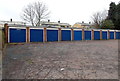
Royal blue lock-up garages, Nolton Place, Cwmbran
Located at the western end of Nolton Place, a cul-de-sac connecting with Waun Road.
Image: © Jaggery
Taken: 9 Mar 2013
0.11 miles