1
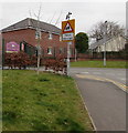
Housing on the west side on Henllys Way, Cwmbran
Viewed from the corner of Ton Road. Jule Road http://www.geograph.org.uk/photo/1794592 is in the background on the far left.
Image: © Jaggery
Taken: 24 Mar 2018
0.03 miles
2
Jule Road, Cwmbran
Viewed from Henllys Way.
Image: © Jaggery
Taken: 8 Apr 2010
0.03 miles
3
Henllys Way mini-roundabout opposite Fairwater Way, Cwmbran
Opposite the eastern end of Fairwater Way.
Image: © Jaggery
Taken: 24 Mar 2018
0.05 miles
4
Henllys Way direction and distances sign, Cwmbran
The sign alongside Henllys Way shows turn left into Fairwater Way https://www.geograph.org.uk/photo/5716938 for the Ty Canol
area of Cwmbran (1 mile) and Fairwater Leisure Centre (three-quarters of a mile).
Image: © Jaggery
Taken: 24 Mar 2018
0.06 miles
5
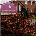
Primary School and Children's Centre nameboard, Cwmbran
The Nant Celyn Primary School and Cwmbran Integrated Children's Centre nameboard
faces Ton Road near these https://www.geograph.org.uk/photo/5716903 entrance gates. The text is also in Welsh.
Image: © Jaggery
Taken: 24 Mar 2018
0.06 miles
6
Windsor Road houses, Cwmbran
Houses on the west side of Windsor Road, viewed from Henllys Way.
Image: © Jaggery
Taken: 8 Apr 2010
0.07 miles
7
Warning sign - Patrol/Hebryngwr, Ton Road, Cwmbran
The English/Welsh sign is near the dark green entrance gates https://www.geograph.org.uk/photo/5716903 to Nant Celyn Primary School.
Image: © Jaggery
Taken: 24 Mar 2018
0.07 miles
8
No motor vehicles ahead except for access, Ton Road, Cwmbran
The signs are near the entrance to Nant Celyn Primary School and 50 metres from the Henllys Way junction.
Image: © Jaggery
Taken: 24 Mar 2018
0.07 miles
9
Ffordd Henllys
Image: © Alan Hughes
Taken: 5 Sep 2022
0.08 miles
10
Welcome to Nant Celyn Primary School, Cwmbran
The board on the left here https://www.geograph.org.uk/photo/5716909 shows that the school name is Ysgol Gynradd Nant Celyn in Welsh.
Image: © Jaggery
Taken: 24 Mar 2018
0.08 miles


