1
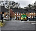
Northern edge of Blenheim Chase, St Dials. Fairwater
Blenheim Chase is a Lovell development of 1- 2- and 3-bedroom houses adjoining Cresswell Walk (at the left edge of the view), on the southern side of Ty Gwyn Road.
Image: © Jaggery
Taken: 30 Jan 2011
0.01 miles
2
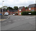
Bungalows, Blenheim Chase, St Dials, Cwmbran
Blenheim Chase is a Lovell development of 1- 2- and 3-bedroom houses adjoining Cresswell Walk, on the southern side of Ty Gwyn Road.
Image: © Jaggery
Taken: 30 Jan 2011
0.01 miles
3
Recently-built houses in St Dials, Cwmbran
Viewed from the corner of Thorncliffe Road in October 2016.
A May 2011 Google Earth Street View shows fenced-off new houses here, looking almost complete externally.
Image: © Jaggery
Taken: 20 Oct 2016
0.04 miles
4
Cresswell Walk houses, St Dials, Cwmbran
The Tamarind https://www.geograph.org.uk/photo/7744345 is behind the camera.
Image: © Jaggery
Taken: 7 Apr 2024
0.04 miles
5
Houses at the southeast end of Thorncliffe Road, Cwmbran
Above Blenheim Road, near the Tamarind. http://www.geograph.org.uk/photo/5166883
Image: © Jaggery
Taken: 20 Oct 2016
0.04 miles
6
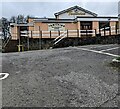
Tamarind restaurant and bar, St Dials, Cwmbran
Indian cuisine restaurant located in the former Marlborough pub above Blenheim Road.
Image: © Jaggery
Taken: 20 Oct 2016
0.06 miles
7
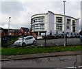
Power Station Community Education Centre, St Dials, Cwmbran
Torfaen County Borough Council building set back from Blenheim Road.
Image: © Jaggery
Taken: 20 Oct 2016
0.06 miles
8
Power Station Community Education Centre, St Dials, Cwmbran
Torfaen County Borough Council building set back from Blenheim Road.
Image: © Jaggery
Taken: 20 Oct 2016
0.06 miles
9
Thorncliffe Road, Cwmbran
Thorncliffe Road descends from Ty Gwyn Road in the Greenmeadow
area of Cwmbran towards Blenheim Road in the St Dials area of Cwmbran.
Image: © Jaggery
Taken: 10 Oct 2016
0.06 miles
10
Tamarind, St Dials, Cwmbran
Viewed from Blenheim Road in April 2024. A board on the wall shows
"TAMARIND
RESTAURANT
& BAR
Contemporary Indian Cuisine
at its Finest"
Image: © Jaggery
Taken: 7 Apr 2024
0.06 miles


