1
Redwick Court, Cwmbran
Viewed across St David's Road.
Image: © Jaggery
Taken: 14 Apr 2017
0.00 miles
2
Castell Howell Foods lorry, St David's Road, Cwmbran
Castell Howell Foods Ltd is based in Cross Hands, Carmarthenshire.
Image: © Jaggery
Taken: 14 Apr 2017
0.02 miles
3
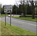
Directions sign near the southern end of St David's Road, Cwmbran
On the approach to a roundabout.
Image: © Jaggery
Taken: 14 Apr 2017
0.03 miles
4
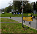
Yellow temporary traffic sign, St David's Road, Cwmbran
The Welsh/English sign is in place on Good Friday April 14th 2017.
Image: © Jaggery
Taken: 14 Apr 2017
0.04 miles
5
Development site, Grange Road, Cwmbran
Behind the locked gates is a pile of rubble, at the southern end of Grange Road.
Image: © Jaggery
Taken: 2 Sep 2011
0.05 miles
6
Floorex direction signs on and near a roundabout, Cwmbran
Showing the way to the nearby Floorex Carpets shop. http://www.geograph.org.uk/photo/5356215
Image: © Jaggery
Taken: 14 Apr 2017
0.05 miles
7
Trees recently in leaf in Cwmbran
On a grass strip between St David's Road and Grange Road viewed on Good Friday April 14th 2017.
Image: © Jaggery
Taken: 14 Apr 2017
0.05 miles
8
Warning sign - humps for 520 yards, Llywelyn Road, Cwmbran
The sign is at the SE end of Llywelyn Road. The brown sign on the right points towards the Community Farm.
Image: © Jaggery
Taken: 23 Sep 2016
0.06 miles
9
Newgale House, Newgale Row, Cwmbran
Located on the corner of Newgale Row and St David's Road, Newgale House contains 8 flats.
The four-storey building is dwarfed by the 22-storey The Tower Block http://www.geograph.org.uk/photo/1611824 at the right edge of the view.
Image: © Jaggery
Taken: 2 Sep 2011
0.06 miles
10
Grange Road and pavement, Cwmbran
Looking north towards the Crane factory site in December 2021.
Image: © Jaggery
Taken: 19 Dec 2021
0.06 miles


