1
SE edge of Cwmbran Shopping Centre
Viewed across Tudor Road. In Cwmbran Shopping Centre, one of the largest in Wales, most of the c200 shops and other business premises are under cover. There are several thousand free car parking spaces within a short distance of the shops. Cwmbran's bus station http://www.geograph.org.uk/photo/1611575 is located in Gwent Square at the eastern edge of the shopping centre.
Image: © Jaggery
Taken: 2 Sep 2011
0.01 miles
2
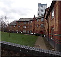
West side of Tŷ Tudur, Cwmbran
Located near Cwmbran Shopping Centre, between Tudor Road and Redbrook Way,
Tŷ Tudur contains 34 flats. The Tower Block http://www.geograph.org.uk/photo/3828457 is in the background.
Image: © Jaggery
Taken: 3 Feb 2014
0.01 miles
3
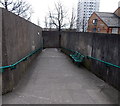
Strangely located benches in Cwmbran
Located alongside a path connecting Cwmbran shopping centre with Radnor Way and Redbrook Way. The benches were surely not put here for the view!
Image: © Jaggery
Taken: 3 Feb 2014
0.02 miles
4
Path signpost, Southville, Cwmbran
Alongside the footpath from Radnor Way towards Cwmbran Shopping Centre.
Image: © Jaggery
Taken: 11 Aug 2017
0.02 miles
5
Yellow and black barrier at the entrance to Tŷ Tudur flats, Cwmbran
The red light is reinforced by a barrier in the road.
Image: © Jaggery
Taken: 3 Feb 2014
0.02 miles
6
Offset houses, Radnor Way, Cwmbran
These houses on the west side of Radnor Way, north of Wentloog Close,
are not aligned at right angles to the roadway.
Image: © Jaggery
Taken: 20 Feb 2013
0.03 miles
7
Cwmbran Clinic, Cwmbran
Cwmbran Clinic is located between Tudor Road and Radnor Way.
The top of The Tower Block http://www.geograph.org.uk/photo/3828457 is in the background.
Image: © Jaggery
Taken: 9 Apr 2017
0.03 miles
8
Wide steps at the southern edge of Cwmbran Shopping Centre
About 16 metres (just over 50 ft) wide.
Image: © Jaggery
Taken: 3 Feb 2014
0.04 miles
9
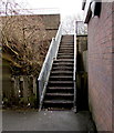
Metal steps up to Cwmbran Shopping Centre
Ascending from Tudor Road to the southern edge of Cwmbran Shopping Centre.
Image: © Jaggery
Taken: 22 Jan 2019
0.04 miles
10
Llys Ynadon Cwmbr?n/Cwmbran Magistrates Court name sign
Welsh/English name on the wall here. https://www.geograph.org.uk/photo/1611832
Image: © Jaggery
Taken: 22 Jan 2019
0.04 miles


