1
Wesley Street, Old Cwmbran
Looking along Wesley Street from Commercial Street.
Image: © Jaggery
Taken: 31 Dec 2009
0.01 miles
2
Prospect Place (N), Old Cwmbran
The northern half of Prospect Place, viewed here from Commercial Street, is separated from the southern half by a 30-metre wide island of trees. http://www.geograph.org.uk/photo/1641001 to the southern half.
Image: © Jaggery
Taken: 31 Dec 2009
0.01 miles
3
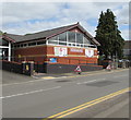
Wesley Community Centre, Cwmbran
Located in Wesley Street. The building, now much modified, was previously Wesleyan Methodist Church. The year 1878 is inscribed on the wall on the far side of the building.
Image: © Jaggery
Taken: 31 Dec 2009
0.01 miles
4
The Mount Pleasant, Wesley Street, Old Cwmbran
Image: © Jaggery
Taken: 31 Dec 2009
0.01 miles
5
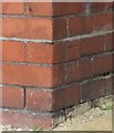
Ordnance Survey Cut Mark
This OS cut mark can be found on No8 Wesley Street. It marks a point 70.473m above mean sea level.
Image: © Adrian Dust
Taken: 10 Sep 2020
0.04 miles
6
Salvation Army Church closed until further notice, Cwmbran
Viewed across Wesley Street on May 15th 2020. In common with other places of worship in the UK, this Salvation Army Church has been closed since late March 2020 during the nationwide Coronavirus (COVID-19) pandemic lockdown.
Image: © Jaggery
Taken: 15 May 2020
0.04 miles
7
Wesley Street houses, Cwmbran
Viewed from the corner of Broadweir Road.
Image: © Jaggery
Taken: 15 May 2020
0.05 miles
8
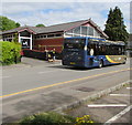
Stagecoach Gold bus 47975, Wesley Street, Cwmbran
On Stagecoach route 6 from Ty Canol to Cwmbran bus station in May 2020.
Image: © Jaggery
Taken: 15 May 2020
0.05 miles
9
Salvation Army private car park, Cwmbran
Set back from the corner of Wesley Street and Broadweir Road near this https://www.geograph.org.uk/photo/6497270 Salvation Army Church.
Image: © Jaggery
Taken: 15 May 2020
0.05 miles
10
Junction of Broadweir Road and Wesley Street, Cwmbran
Viewed across Wesley Street looking to the southeast along Broadweir Road.
Image: © Jaggery
Taken: 15 May 2020
0.05 miles


