1
East along Bellevue Road, Cwmbran
The row of houses extends for about 140 metres along the south side of Bellevue Road.
Image: © Jaggery
Taken: 7 Dec 2014
0.00 miles
2
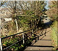
Steps down from Henllys Way, Cwmbran
The steps are at the western edge of the bridge http://www.geograph.org.uk/photo/3249067 carrying Henllys Way over Cwmbran Drive.
The corner of Abbey Road and Belle Vue Road is at the bottom of the steps.
Image: © Jaggery
Taken: 1 Dec 2012
0.02 miles
3
Direction and distances sign on a Henllys Way pedestrian refuge, Cwmbran
2 miles from Ty Canol and 2 miles from Henllys.
Image: © Jaggery
Taken: 24 Mar 2018
0.05 miles
4
Tack&Feed, Old Cwmbran
Horse supplies shop located on Oldbury Retail Park, Oldbury Road.
Image: © Jaggery
Taken: 31 Dec 2009
0.05 miles
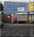
5
What! store, Old Cwmbran
Located in Oldbury Retail Park, Oldbury Road.
What! is a store selling a wide variety of household items, including beds and bedding, kitchenware, cookware, DIY tools and accessories, pictures and mirrors.
Image: © Jaggery
Taken: 31 Dec 2009
0.05 miles
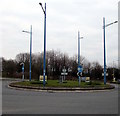
6
Lampposts on a Cwmbran roundabout
At the Henllys Way/Cwmbran Drive/Ty Coch Way crossroads.
Image: © Jaggery
Taken: 24 Mar 2018
0.05 miles
7
Henllys Way bridge over Cwmbran Drive, Cwmbran
Henllys Way crosses over Cwmbran Drive (the A4051).
Much of Cwmbran Drive, as here, is along the trackbed of a dismantled railway.
There was no bridge shown here on a 1940s map, when the railway was still in use,
because Henllys Way did not exist at that time.
Image: © Jaggery
Taken: 1 Dec 2012
0.06 miles
8
Bellevue Close, Cwmbran
Viewed from the Star Street end. The back gardens of the houses
at the far end of Bellevue Close abut the back gardens of Abbey Road houses.
Image: © Jaggery
Taken: 7 Dec 2014
0.06 miles
9
Belle Vue Sheltered Housing, Cwmbran
Viewed across Bellevue Close.
The nameboard shows Private Access for Residents Only. NO THOROUGHFARE.
Image: © Jaggery
Taken: 7 Dec 2014
0.06 miles
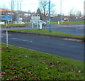
10
No pedestrians sign, Cwmbran
Presumably the sign is intended to prevent pedestrians crossing the road here, near the busy junction of Cwmbran Drive, Ty Coch Way and Henllys Way. It can't apply to the location of the photographer who is standing on a footpath...
Image: © Jaggery
Taken: 1 Dec 2012
0.06 miles


