1
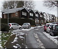
Chepstow Rise houses, Croesyceiliog, Cwmbran
On the north side of Chepstow Rise on the ascent from Caerwent Road towards Edlogan Way.
Image: © Jaggery
Taken: 5 Mar 2018
0.04 miles
2
Chepstow Rise, Croesyceiliog
From Edlogan Way.
Image: © Jaggery
Taken: 8 Oct 2009
0.06 miles
3
Deciduous trees and snow remnants, Croesyceiliog, Cwmbran
Remains of the March 1st-2nd snowfall viewed from Caerwent Road on March 5th 2018.
Image: © Jaggery
Taken: 5 Mar 2018
0.07 miles
4
Pontrhydyrun Baptist Church
Viewed from Chapel Lane. The date on the building (here obscured by a tree) is 1836. The date of the founding of the church (presumably a temporary structure) shown on a roundel on another part of the church http://www.geograph.org.uk/photo/1526151 is 1807.
Image: © Jaggery
Taken: 8 Oct 2009
0.07 miles
5
Pontrhydyrun Baptist Church, NE entrance
The inscription on the black roundel located above the name of the church reads "George Conway and family founded this church in 1807".
The Conway family were tinplate manufacturers.
Image: © Jaggery
Taken: 8 Oct 2009
0.07 miles
6
Pontrhydyrun Baptist Church manse
The manse is adjacent to the church. http://www.geograph.org.uk/photo/1526128
Image: © Jaggery
Taken: 8 Oct 2009
0.07 miles
7
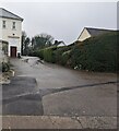
Access road to Pontrhydyrun Baptist Church (Evangelical), Ciwmbran
Dead-end road viewed from Chapel Lane.
Image: © Jaggery
Taken: 24 Dec 2023
0.07 miles
8
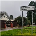
Bilingual Crematorium direction sign, Chapel Lane, Cwmbran
Crematorium is Amlosgfa in Welsh.
Image: © Jaggery
Taken: 24 Dec 2023
0.08 miles
9
Up Chepstow Rise, Croesyceiliog, Cwmbran
Viewed from the corner of Caerwent Road. Chepstow Rise ascends towards Edlogan Way.
Image: © Jaggery
Taken: 5 Mar 2018
0.08 miles
10
Pontrhydyrun Baptist Church (Evangelical) information boards, Cwmbran
Outside this https://www.geograph.org.uk/photo/7678145 Grade II Listed church.
In December 2023 the board on the right shows that Sunday Services begin at 11am.
Image: © Jaggery
Taken: 24 Dec 2023
0.09 miles


