1
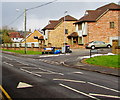
Woodland View, Croesyceiliog, Cwmbran
Cul-de-sac of eight houses built in 2001 viewed across Woodland Road.
Image: © Jaggery
Taken: 7 Mar 2018
0.01 miles
2
SE side of St Mary's Church, Croesyceiliog, Cwmbran
The Church in Wales church is located on St Mary's Road, Croesyceiliog.
http://www.geograph.org.uk/photo/2598971 to a view from the opposite direction.
Image: © Jaggery
Taken: 13 Sep 2011
0.02 miles
3
NW side of St Mary's Church, Croesyceiliog, Cwmbran
The Church in Wales church is located on St Mary's Road, Croesyceiliog.
http://www.geograph.org.uk/photo/2598964 to a view from the opposite side.
Image: © Jaggery
Taken: 13 Sep 2011
0.02 miles
4
Wheelie bins and recycling boxes, Woodland View, Croesyceiliog, Cwmbran
On the corner of Woodland Road. The name sign shows that Woodland View is Golygfa'r Goedwig in Welsh.
Image: © Jaggery
Taken: 7 Mar 2018
0.03 miles
5
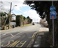
Woodland Road speed bump, Croesyceiliog, Cwmbran
A painted white triangle draws attention to the bump, one of several
on Woodland Road. This one is near the Woodland View junction.
Image: © Jaggery
Taken: 7 Mar 2018
0.04 miles
6
Woodland Road bus stop, Croesyceiliog, Cwmbran
In March 2018 this stop is for buses on Stagecoach Route 2 from Croesyceiliog to Cwmbran bus station.
Image: © Jaggery
Taken: 7 Mar 2018
0.04 miles
7
Corner of Bryn Eglwys and St Mary's Road, Croesyceiliog, Cwmbran
Viewed across Bryn Eglwys. Turn right here into St Mary's Road for St Mary's church.
Image: © Jaggery
Taken: 13 Sep 2011
0.04 miles
8
National Cycle Network Route 46 sign, Woodland Road, Croesyceiliog, Cwmbran
The Sustrans website states that National Cycle Network Route 46 will connect Bromsgrove with Neath when complete.
Image: © Jaggery
Taken: 7 Mar 2018
0.04 miles
9
Woodland Road bus stop, Croesyceiliog, Cwmbran
In March 2018 the stop is on Stagecoach bus route 2 from Cwmbran bus station to Croesyceiliog.
Image: © Jaggery
Taken: 7 Mar 2018
0.05 miles
10
Bryn Eglwys houses, Croesyceiliog, Cwmbran
Set back from the road named Bryn Eglwys (Welsh for Church Hill).
Image: © Jaggery
Taken: 24 Dec 2023
0.05 miles


