1
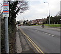
Turnpike Road houses near the corner of Plantation Drive, Croesyceiliog, Cwmbran
Viewed across Turnpike Road.
Image: © Jaggery
Taken: 13 Sep 2011
0.02 miles
2
Three-way junction in Croesyceiliog, Cwmbran
The eastern end of Woodland Road on the right is where The Highway on the camera side becomes Turnpike Road ahead.
Image: © Jaggery
Taken: 27 Feb 2018
0.04 miles
3
Virgin Media telecoms cabinet, Turnpike Road, Croesyceiliog, Cwmbran
The number 20 is on the front and side of the dark green cabinet.
Image: © Jaggery
Taken: 27 Feb 2018
0.04 miles
4
Cold Calling Control Zone in Croesyceiliog, Cwmbran
The Trading Standards Notice alongside Turnpike Road states that this area is a Cold Calling Control Zone and shows a number to phone if you are cold called. Cold calling is the contacting by businesses or their agents of people thought to be potential customers, without the contact having been prearranged.
Image: © Jaggery
Taken: 15 Feb 2015
0.05 miles
5
BT telecoms cabinet on a Croesyceiliog corner, Cwmbran
The dark green cabinet is on the corner of Woodland Road and Turnpike Road.
Image: © Jaggery
Taken: 27 Feb 2018
0.05 miles
6
Plantation Drive, Croesyceiliog
Looking east from Turnpike Road.
Image: © Jaggery
Taken: 8 Oct 2009
0.05 miles
7
Plantation Drive houses in Croesyceiliog, Cwmbran
Viewed from Turnpike Road. The back gardens of these houses are at the edge of a wood named The Plantation.
Image: © Jaggery
Taken: 15 Feb 2015
0.06 miles
8
Fenced-off former Texaco filling station and shop, Croesyceiliog, Cwmbran
Viewed across The Highway in February 2018. The site has been derelict for several years.
Image: © Jaggery
Taken: 27 Feb 2018
0.07 miles
9
Lockup garages in Croesyceiliog,Cwmbran
Private car park - residents only. Located on the east side of the Turnpike Road roundabout,
alongside the entrance road to the site of the demolished former County Hall.
Image: © Jaggery
Taken: 15 Feb 2015
0.07 miles
10
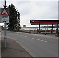
Warning sign - humps for 700 yards, The Highway, Croesyceiliog, Cwmbran
The sign warns of humps along Woodland Road. The text is also in Welsh.
A fenced-off former Texaco filling station is on the right. https://www.geograph.org.uk/photo/5710149
Image: © Jaggery
Taken: 27 Feb 2018
0.07 miles


