1
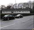
Row of houses behind a Grove Park hedge, Cwmbran
Located between Grove Park and Tynewydd Avenue.
Image: © Jaggery
Taken: 6 Mar 2019
0.00 miles
2
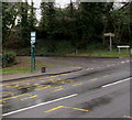
Grove Park bus stop, Cwmbran
In March 2019 this stop near the corner of Tynewydd Avenue is for
buses on Stagecoach Route 15 to Newport via Cwmbran bus station.
Image: © Jaggery
Taken: 6 Mar 2019
0.02 miles
3
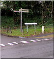
Active Travel signpost on a Cwmbran corner
On the corner of Grove Park and Tynewydd Avenue viewed in March 2019. The Torfaen County Borough website states that in September 2014, the Welsh Government introduced the Active Travel (Wales) Act 2013 which places a legal requirement on local authorities in Wales to map, plan, improve and promote routes deemed suitable for active travel. Active travel means walking and cycling for everyday short-distance journeys, such as journeys to school, work, or for access to shops or services. Active travel does not include journeys purely made for recreation or social reasons.
Image: © Jaggery
Taken: 6 Mar 2019
0.03 miles
4
Public footpath direction sign, Grove Park, Cwmbran
The sign points towards this https://www.geograph.org.uk/photo/6108621 grassy section of public footpath.
Image: © Jaggery
Taken: 6 Mar 2019
0.04 miles
5
Grove Park houses, Cwmbran
Houses on the north side of the road named Grove Park, on the climb up from the roundabout at the junction with Cwmbran Drive (A4051).
Image: © Jaggery
Taken: 23 Sep 2010
0.04 miles
6
Pontrhydyrun Road houses, Cwmbran
Looking along Pontrhydyrun Road towards the Cwmbran Drive (A4051) roundabout.
Image: © Jaggery
Taken: 23 Sep 2010
0.05 miles
7
Cwmbran Drive heading north from Grove Park and Pontrhydyrun Road
Cwmbran Drive (A4051) heads north away from the roundabout at which Grove Park from the west (left) and Pontrhydyrun Road from the east join the A road. The large white sign on the right points to Panteg and Griffithstown. The smaller white sign on the left edge of the photo points to Pontnewydd and Upper Cwmbran.
Image: © Jaggery
Taken: 23 Sep 2010
0.05 miles
8
Roundabout at an intersection in Cwmbran Drive, Cwmbran
In the middle of the A4051 Cwmbran Drive at the Grove Park junction and Pontrhydyrun Road junction.
Image: © Jaggery
Taken: 6 Mar 2019
0.05 miles
9
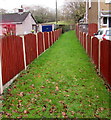
Public footpath between fences, Cwmbran
On the north side of (the road named) Grove Park, opposite the Tynewydd Avenue junction.
Image: © Jaggery
Taken: 6 Mar 2019
0.05 miles
10
Pedestrian refuge at the southwest end of Pontrhydyrun Road, Cwmbran
On the approach to the A4051 Cwmbran Drive.
Image: © Jaggery
Taken: 6 Mar 2019
0.07 miles


