1
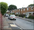
Central section of Porth Mawr Road, Cwmbran
Looking north from the corner of Plas Islwyn.
Image: © Jaggery
Taken: 20 Jul 2011
0.02 miles
2
Northern section of Porth Mawr Road, Cwmbran
The view NNE from the corner of Mead Lane. http://www.geograph.org.uk/photo/2514277
Image: © Jaggery
Taken: 20 Jul 2011
0.02 miles
3
96-86 Porth Mawr Road, Cwmbran
Viewed from opposite the Ty Mynydd http://www.geograph.org.uk/photo/2514297 junction. The row contains six houses, 96 to 86 Porth Mawr Road (even numbers only).
Image: © Jaggery
Taken: 20 Jul 2011
0.05 miles
4
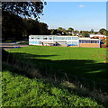
Maendy Primary School, Cwmbran
Viewed from Maendy Way. The school is accessed from Wayfield Crescent.
Image: © Jaggery
Taken: 5 Oct 2016
0.05 miles
5
Mead Lane, Cwmbran
Viewed from Porth Mawr Road, looking towards Maendy Primary School.
Image: © Jaggery
Taken: 20 Jul 2011
0.05 miles
6
Maendy Primary School, Cwmbran
Viewed from Wayfield Crescent. This is one of two buildings on the school site, which formerly contained Maendy Junior School and Maendy Infants School. The schools are now combined as Maendy Primary School.
Image: © Jaggery
Taken: 20 Jul 2011
0.05 miles
7
Southern side of Maendy Primary School, Cwmbran
Viewed from Maendy Way. This is one of two buildings on the school site, which formerly contained Maendy Junior School and Maendy Infants School. The schools are now combined as Maendy Primary School.
Image: © Jaggery
Taken: 13 Oct 2011
0.05 miles
8
Northville, Cwmbran
From Maendy Way. The Northville area of Cwmbran is between the town centre and the Pontnewydd area.
Image: © Jaggery
Taken: 5 Oct 2016
0.05 miles
9
Wayfield Crescent, Cwmbran
Houses at the northern end of Wayfield Crescent, viewed from the southern end of Cromwell Place.
Image: © Jaggery
Taken: 20 Jul 2011
0.07 miles
10
Trussel Road, Cwmbran
Houses on the south side of Trussel Road, viewed from the St David's Road end.
Image: © Jaggery
Taken: 23 Sep 2010
0.08 miles


