1
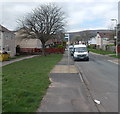
Houses in The Rise, West Pontnewydd, Cwmbran
Viewed from the corner of Maendy Wood Rise.
Image: © Jaggery
Taken: 9 Apr 2014
0.03 miles
2
Houses alongside a Maendy Wood Rise green, Cwmbran
The houses on the right are in Maendy Wood Rise. The houses behind them are in The Rise.
Image: © Jaggery
Taken: 9 Apr 2014
0.03 miles
3
Alternating blue and white lockup garages in West Pontnewydd, Cwmbran
Alongside Bryn Celyn Road near the corner of Maendy Wood Rise.
Image: © Jaggery
Taken: 9 Apr 2014
0.04 miles
4
The Leas, Cwmbran
Viewed across Bryn Celyn Road.
Image: © Jaggery
Taken: 9 Apr 2014
0.04 miles
5
Long row of houses, Bryn Celyn Road, Cwmbran
Viewed from the corner of Maendy Wood Rise.
Image: © Jaggery
Taken: 9 Apr 2014
0.05 miles
6
Nonconformity in West Pontnewydd, Cwmbran
5 Bryn Celyn Road lockup garages, 5 colours, 5 designs.
Image: © Jaggery
Taken: 9 Apr 2014
0.05 miles
7
Sealed-up former postbox in West Pontnewydd Cwmbran
Viewed in April 2014. Located http://www.geograph.org.uk/photo/3923984 on the corner of Bryn Celyn Road
and the entrance road to Pontnewydd Primary School. A Google Earth
Street View taken in August 2008 shows the box unsealed and in use,
with a collection times notice where the rusty rectangle is now.
Image: © Jaggery
Taken: 9 Apr 2014
0.05 miles
8
Disused postbox in a brick column in West Pontnewydd Cwmbran
The box http://www.geograph.org.uk/photo/3923981 is sealed and looks long disused. The location is the corner of Bryn Celyn Road and the entrance road to Pontnewydd Primary School.
Image: © Jaggery
Taken: 9 Apr 2014
0.05 miles
9
Eastern end of Maendy Wood Rise, Cwmbran
Viewed from Bryn Celyn Road. The far end of Maendy Wood Rise is at the Maendy Way junction.
Image: © Jaggery
Taken: 9 Apr 2014
0.06 miles
10
Path between two hedges, Bryn Celyn Road, Cwmbran
The hedge on the left is alongside Bryn Celyn Road opposite Bryn Celyn Place.
Image: © Jaggery
Taken: 9 Apr 2014
0.06 miles


