1
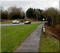
Farm building, Bevan's Lane, Sebastopol
Located on the south side of Bevan's Lane.
Image: © Jaggery
Taken: 26 Mar 2011
0.03 miles
2
Bevan's Lane, Sebastopol
Bevan's Lane heads away from the Cwmbran Drive / Avondale Road roundabout.
Image: © Jaggery
Taken: 21 Oct 2009
0.03 miles
3
Derelict hay barn, Bevan's Lane
This disused barn will be in the middle of a housing estate, but will be retained (but for how long?) because it contains a bat roost.
Image: © M J Roscoe
Taken: 12 Apr 2019
0.04 miles
4
Ffordd Tir Brychiad, Edlogan Wharf estate
Newly completed residential road on new large housing development. Notice lack of road markings and unfinished pavements
Image: © M J Roscoe
Taken: 12 Apr 2019
0.06 miles
5
Housing estate under construction
New bridge and new house, part of Edlogan Wharf estate, on greenfield site. The bridge spans a small stream.
Image: © M J Roscoe
Taken: 12 Apr 2019
0.07 miles
6
Pontrhydyrun 1st railway station (site), Gwent
Opened in 1852 by the Monmouthshire Railway, later part of the Great Western Railway, on its line from Newport to Pontypool (Crane Street) and Blaenavon, this station closed in 1917.
View south towards Upper Pontnewydd and Newport. Also, a later station was opened as Pontrhydyrun Halt in 1933, some 400m south of here. That in turn closed in 1962.
The wall on the right may have been part of the northbound platform (confirmation required).
Image: © Nigel Thompson
Taken: 14 Mar 2015
0.08 miles
7
Track to Wren's Nest Cottages, Sebastopol
The 100-metre long track heads SW away from Bevan's Lane.
Image: © Jaggery
Taken: 26 Mar 2011
0.09 miles
8
Path alongside Cwmbran Drive, Cwmbran
Looking north past the start/end of the metal barrier at the edge of the pavement on the east side of the A4051 Cwmbran Drive.
Image: © Jaggery
Taken: 6 Mar 2019
0.09 miles
9
Cycle track north from Bevan's Lane
NCR 492 here is on the course of a dismantled railway now running between housing estates under construction. The alignment of the track appears to have been modified, and the blue sign may be facing the wrong way.
Image: © M J Roscoe
Taken: 12 Apr 2019
0.10 miles
10
Corrugated farm building, Bevan's Lane, Sebastopol
Located in a field opposite Tir-brychiad farmhouse. http://www.geograph.org.uk/photo/2789132
Image: © Jaggery
Taken: 26 Mar 2011
0.11 miles


