IMAGES TAKEN NEAR TO
Caroline Road, PONTYPOOL, NP4 0QL
Introduction
This page details the photographs taken nearby to Caroline Road, NP4 0QL by members of the Geograph project.
The Geograph project started in 2005 with the aim of publishing, organising and preserving representative images for every square kilometre of Great Britain, Ireland and the Isle of Man.

There are currently over 7.5m images from over14,400 individuals and you can help contribute to the project by visiting https://www.geograph.org.uk
Image Map
Images are licensed for reuse under creativecommons.org/licenses/by-sa/2.0
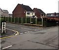
Notes
- Clicking on the map will re-center to the selected point.
- The higher the marker number, the further away the image location is from the centre of the postcode.
Image Listing (100 Images Found)
Images are licensed for reuse under creativecommons.org/licenses/by-sa/2.0
Image
Details
Distance
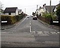
1
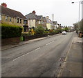
Southeastwards along The Highway, New Inn
Towards the main area of shops and other businesses in New Inn.
A speed camera sign is on the lamppost on the right.
Image: © Jaggery
Taken: 11 Apr 2018
0.05 miles
2
Bus stop alongside The Highway, New Inn
For buses to Cwmbran bus station. In April 2018 this stop
is on Stagecoach bus routes 15 and 23 and Phil Anslow bus route 30.
Image: © Jaggery
Taken: 11 Apr 2018
0.05 miles
3
Corner of Ruth Road and The Highway, New Inn
Viewed across The Highway. This is one of two junctions of these roads.
The other one https://www.geograph.org.uk/photo/5735583 is 180 metres to northwest.
Image: © Jaggery
Taken: 11 Apr 2018
0.07 miles
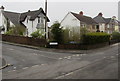
4
Stone house and a brick house in New Inn
Viewed across The Highway.
Image: © Jaggery
Taken: 11 Apr 2018
0.07 miles
5
Up Ruth Road, New Inn
Ruth Road ascends from The Highway. This is one of two junctions of these roads.
The other one https://www.geograph.org.uk/photo/5735583 is 180 metres to northwest.
Image: © Jaggery
Taken: 11 Apr 2018
0.07 miles
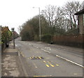
6
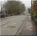
Northwestwards along The Highway, New Inn
The yellow car has just left Ruth Road. A speed camera sign is on the lamppost on the left.
Image: © Jaggery
Taken: 11 Apr 2018
0.08 miles
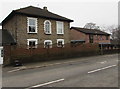
7
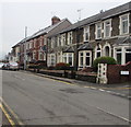
Houses alongside The Highway, New Inn
Northwest of the Golf Road junction. The name sign on the right shows that Golf Road is Heol Golff in Welsh.
Image: © Jaggery
Taken: 12 Apr 2018
0.09 miles
8
Golf Road, New Inn
Ascending from The Highway, Golf Road leads to Jerusalem Lane 900 metres ahead.
Image: © Jaggery
Taken: 12 Apr 2018
0.12 miles
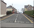
9
Corner of The Highway and Golf Road, New Inn
Golf Road on the left diverges from The Highway, the main road through New Inn.
Image: © Jaggery
Taken: 12 Apr 2018
0.13 miles
10
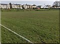
Home ground of New Inn AFC, Torfaen
Viewed in March 2024 when the football club's first team is in Gwent County Division 1.
The clubhouse https://www.geograph.org.uk/photo/7738015 is behind the camera.
Image: © Jaggery
Taken: 31 Mar 2024
0.14 miles