1
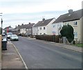
Jerusalem Lane bungalows, New Inn
Viewed from the corner of Sluvad Road.
Image: © Jaggery
Taken: 6 Feb 2012
0.02 miles
2
Glascoed Road, New Inn, Pontypool
Houses at the southern end of Glascoed Road, viewed across Festival Crescent.
Image: © Jaggery
Taken: 21 Jan 2011
0.07 miles
3
Festival Crescent, New Inn
Houses on the south side of Festival Crescent, close to its southern junction with
Jerusalem Lane. The crescent rejoins Jerusalem Lane about 250 metres north of this point.
Image: © Jaggery
Taken: 17 Jan 2010
0.10 miles
4
Corner of Festival Crescent and Jerusalem Lane, New Inn
This is the southern edge of Festival Crescent where it joins Jerusalem Lane. Festival Crescent loops around the west of Jerusalem Lane and rejoins it about 250 metres northeast of here. http://www.geograph.org.uk/photo/1677200
Image: © Jaggery
Taken: 17 Jan 2010
0.10 miles
5
Sluvad Road, New Inn
Sluvad Road heads away from Jerusalem Lane towards Sluvad Farm (about 1km away), and Llandegfedd Reservoir (about 2km away).
Image: © Jaggery
Taken: 17 Jan 2010
0.11 miles
6
Sluvad Road houses, New Inn
Houses on the south side of Sluvad Road, adjacent to the Jerusalem Road junction.
Image: © Jaggery
Taken: 17 Jan 2010
0.11 miles
7
30mph speed limit at the western end of Sluvad Road near New Inn
At the approach to a group of houses http://www.geograph.org.uk/photo/1677181 at the western end of Sluvad Road, the National Speed Limit reduces to a 30mph speed limit.
Image: © Jaggery
Taken: 6 Feb 2012
0.11 miles
8
Llandegfedd Way houses, New Inn
Llandegfedd Way is on the NE side of The Highway, the main road through New Inn.
Image: © Jaggery
Taken: 12 Apr 2018
0.11 miles
9
Festival Crescent houses, New Inn, Pontypool
Houses on the west side of Festival Crescent, south of Glascoed Road. http://www.geograph.org.uk/photo/2244880
The man at the top of a ladder on the left is a BT engineer examining a telephone pole.
Image: © Jaggery
Taken: 21 Jan 2011
0.11 miles
10
Glosters Parade, New Inn, Pontypool
Houses on the corner of Glosters Parade, viewed across Festival Crescent.
Image: © Jaggery
Taken: 21 Jan 2011
0.12 miles


