1
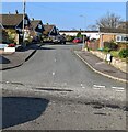
Up Highfield, Penperlleni
Highfield ascends from the west side of Capel Ed Lane.
Image: © Jaggery
Taken: 27 Mar 2022
0.03 miles
2
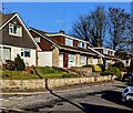
Houses, trees and blue sky, Capel Ed Lane, Penperlleni
The house on the left is on the corner of Meadowbank.
Image: © Jaggery
Taken: 27 Mar 2022
0.06 miles
3
Street name in a hedge, Penperlleni
The Longhouse Barn name sign is in the hedge at the corner of Capel Ed Lane.
Image: © Jaggery
Taken: 27 Mar 2022
0.06 miles
4
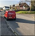
Dark red van, Capel Ed Lane, Penperlleni
Text on the van in March 2022 includes
"RGH maintenance" and "Russ Howitt Decorating Services".
The Highfield junction is on the right.
Image: © Jaggery
Taken: 27 Mar 2022
0.06 miles
5
Junction of Highfield and Capel Ed Lane, Penperlleni
Viewed across Capel Ed Lane.
Image: © Jaggery
Taken: 27 Mar 2022
0.06 miles
6
Rooftop solar panels, Capel Ed Lane, Penperlleni
Optimally located on a south facing roof.
Image: © Jaggery
Taken: 27 Mar 2022
0.07 miles
7
Long-roofed houses, Penperlleni
The houses are on the east side of Capel Ed Lane.
Image: © Jaggery
Taken: 30 Jun 2011
0.07 miles
8
Up Meadowbank, Penperlleni
Meadowbank ascends from Capel Ed Lane.
Image: © Jaggery
Taken: 27 Mar 2022
0.08 miles
9
Capel Ed, Penperlleni
On Capel Ed Lane in the Penperlleni area of Goetre (AKA Goytre to some locals)
in Sir Fynwy / Monmouthshire.
Image: © Stephen Wilks
Taken: Unknown
0.09 miles
10
Capel Ed, Penperlleni
An inscription on the building shows that the chapel was built in 1807.
Previously, Coedcae Farm occupied the ground where the chapel is now.
For many years before the chapel was built, services were held in the farmhouse kitchen.
The unusual name of the chapel is taken from the Bible (Joshua 22:34)
"And the children of Reuben and the children of Gad called the altar Ed".
Image: © Jaggery
Taken: 30 Jun 2011
0.09 miles


