1
Queen Elizabeth II pillarbox and Royal Mail drop box, Main Road, Portskewett
Near the corner of Laburnum Terrace.
Image: © Jaggery
Taken: 11 Mar 2018
0.03 miles
2
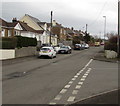
Main Road, Portskewett
Looking to the ENE along Main Road past the Station Road junction.
Image: © Jaggery
Taken: 11 Mar 2018
0.04 miles
3
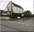
SE along Station Road, Portskewett, Monmouthshire
Station Road formerly led to Portskewett railway station where passenger
services ended in 1964. Station Road now leads to Sunnycroft and Hill Barn View.
Image: © Jaggery
Taken: 20 Aug 2023
0.05 miles
4
Station Road, Portskewett
From Main Road, Station Road leads to Sunnycroft and Hill Barn View.
This used to be the way to Portskewett railway station where passenger services ended in 1964.
Image: © Jaggery
Taken: 11 Mar 2018
0.05 miles
5
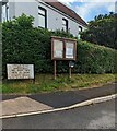
Corner of Main Road and Station Road, Portskewett
A parish noticeboard is alongside Station Road.
Image: © Jaggery
Taken: 11 Mar 2018
0.06 miles
6
Footbridge at site of Portskewett station
Image: © Gareth James
Taken: 23 Mar 2013
0.06 miles
7
Station Road noticeboard, Portskewett, Monmouthshire
Viewed from the corner of Main Road. Station Road formerly led to
Portskewett railway station where passenger services ended in 1964.
The sign shows that Station Road now leads to Sunnycroft and Hill
Barn View. The sign text is also in Welsh.
Image: © Jaggery
Taken: 20 Aug 2023
0.07 miles
8
Portskewett news
A noticeboard with an additional little extra container.
Image: © Neil Owen
Taken: 20 Apr 2023
0.07 miles
9
Corner of Main Road and Black Rock Road, Portskewett
On the left side of the house, a National Speed Limit sign marks the end of the 30mph speed limit in Portskewett. On the right, Black Rock Road heads SE to a picnic and viewing area on the edge of the Severn Estuary, about 750 metres away.
Image: © Jaggery
Taken: 8 Sep 2010
0.07 miles
10
Portskewett : turn right for Black Rock
At the SE edge of Portskewett, a sign indicates turn right for Black Rock Picnic and Lave Net Fishery Site. Next to the National Speed Limit sign (black diagonal line on white background) is a wind- and solar-powered sign.http://www.geograph.org.uk/photo/2061300
Image: © Jaggery
Taken: 8 Sep 2010
0.07 miles


