IMAGES TAKEN NEAR TO
Green Court, CALDICOT, NP26 4HJ
Introduction
This page details the photographs taken nearby to Green Court, NP26 4HJ by members of the Geograph project.
The Geograph project started in 2005 with the aim of publishing, organising and preserving representative images for every square kilometre of Great Britain, Ireland and the Isle of Man.

There are currently over 7.5m images from over14,400 individuals and you can help contribute to the project by visiting https://www.geograph.org.uk
Image Map
Images are licensed for reuse under creativecommons.org/licenses/by-sa/2.0
Notes
- Clicking on the map will re-center to the selected point.
- The higher the marker number, the further away the image location is from the centre of the postcode.
Image Listing (59 Images Found)
Images are licensed for reuse under creativecommons.org/licenses/by-sa/2.0
Image
Details
Distance
1
Ordnance Survey Cut Mark
This OS cut mark can be found on No204 Newport Road. It marks a point 11.970m above mean sea level.
Image: © Adrian Dust
Taken: 7 Oct 2021
0.04 miles
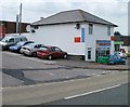
2
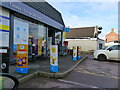
The Co-op supermarket, Newport Road, Caldicot
Image: © Ruth Sharville
Taken: 23 Nov 2020
0.05 miles
3
Corner of Shakespeare Drive, Caldicot
Viewed across Newport Road.
Image: © Jaggery
Taken: 14 Aug 2010
0.06 miles
4
Caldicot Labour Club
Club and institute located at 182 Newport Road.
Image: © Jaggery
Taken: 14 Aug 2010
0.06 miles
5
Chef's Fried Chicken, Caldicot
Takeaway at 180 Newport Road.
Image: © Jaggery
Taken: 14 Aug 2010
0.11 miles
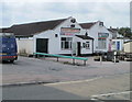
6
The Galleon, Newport Road, Caldicot
Pub set back from Newport Road, adjacent to the Chef's Fried Chicken. http://www.geograph.org.uk/photo/2012574
Image: © Jaggery
Taken: 14 Aug 2010
0.11 miles
7
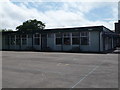
West End Infants' School, Caldicot
Rear view of the school and playground. The school was demolished in 2015 and new builds are in progress.
Image: © Mrs Blorenge
Taken: 17 Jul 2012
0.12 miles
8
Caldicot : Newport Road houses
Viewed from the edge of Caldicot Fire Station. http://www.geograph.org.uk/photo/2012493
Image: © Jaggery
Taken: 14 Aug 2010
0.13 miles
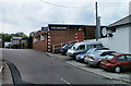
9
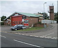
Caldicot Fire Station
Fire station and training tower located on the corner of Newport Road and Woodstock Close.
In addition to the town of Caldicot, the fire station serves the neighbouring villages of Rogiet, Portskewett, Magor, Undy and Sudbrook. It also covers a number of smaller communities along the A48 between Newport and Chepstow. The station provides secondary fire cover to the fire station in Chepstow and the one in Maindee, Newport.
The station also deals with incidents in and around the Severn Tunnel, for which it is equipped with a road/rail vehicle.
Image: © Jaggery
Taken: 14 Aug 2010
0.13 miles
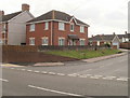
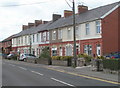
10
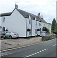
Newport Road houses, Caldicot
Houses on the SE side of the road, between Woodstock Close and Yew Tree Close.
Image: © Jaggery
Taken: 14 Aug 2010
0.13 miles