IMAGES TAKEN NEAR TO
Millfield Park, CALDICOT, NP26 3LF

Introduction

This page details the photographs taken nearby to Millfield Park, NP26 3LF by members of the Geograph project.

The Geograph project started in 2005 with the aim of publishing, organising and preserving representative images for every square kilometre of Great Britain, Ireland and the Isle of Man.

There are currently over 7.5m images from over14,400 individuals and you can help contribute to the project by visiting https://www.geograph.org.uk

Image Map


Images are licensed for reuse under creativecommons.org/licenses/by-sa/2.0
Notes
  • Clicking on the map will re-center to the selected point.
  • The higher the marker number, the further away the image location is from the centre of the postcode.

Image Listing (137 Images Found)

Images are licensed for reuse under creativecommons.org/licenses/by-sa/2.0
  • ...
Image
Details
Distance
1
Millfield Park, Undy
Cul-de-sac viewed across Dancing Hill.
Image: © Jaggery Taken: 11 Feb 2018
0.04 miles
2
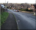
Down Dancing Hill, Undy
Dancing Hill descends from Undy towards Magor. The Dinch Hill junction is on the left.
Image: © Jaggery Taken: 11 Feb 2018
0.06 miles
3
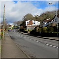
Up Dancing Hill, Undy
Dancing Hill ascends northeastwards towards Grange Road and Quarry Rise.
Image: © Jaggery Taken: 11 Feb 2018
0.06 miles
4
Public footpath in Undy
On the northwest side of Dancing Hill near the Grange Road junction.
Image: © Jaggery Taken: 11 Feb 2018
0.06 miles
5
Junction of Grange Road and Dancing Hill, Undy
Grange Road climbs away from Dancing Hill.
Image: © Jaggery Taken: 11 Feb 2018
0.07 miles
6
Dancing Hill, Magor
Dancing Hill (Bryn Dawnsio in Welsh) ascends from the B4245 Main Road. The left turn 60 metres ahead is into the cul-de-sac Cowleaze. https://www.geograph.org.uk/photo/5678391 Beyond the Cowleaze junction, Dancing Hill crosses over Mill Reen https://www.geograph.org.uk/photo/5678400 which here marks the Magor/Undy boundary.
Image: © Jaggery Taken: 4 Feb 2018
0.07 miles
7
Dinch Hill electricity substation, Undy
The Western Power Distribution electricity substation is on the corner of Dinch Hill and Dancing Hill. Its identifier is DINCH HILL S/S 536699.
Image: © Jaggery Taken: 11 Feb 2018
0.07 miles
8
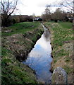
Mill Reen between Magor and Undy, Monmouthshire
Viewed from the corner of Cowleaze and Dancing Hill. The drainage channel Mill Reen here marks the boundary between Magor on the left and Undy on the right. The two villages form the community and parish of Magor with Undy. A footbridge over Mill Reen is in the background.
Image: © Jaggery Taken: 11 Feb 2018
0.07 miles
9
Knollbury this way from Undy
On the right, a small sign showing Knollbury points towards the road ascending on the left. This junction marks the transition from Dancing Hill (in the lower left corner) to Quarry Rise.
Image: © Jaggery Taken: 11 Feb 2018
0.08 miles
10
End of the 30 zone at the northern edge of Undy, Monmouthshire
The 30mph speed limit on Grange Road increases to the National Speed Limit.
Image: © Jaggery Taken: 11 Feb 2018
0.08 miles
  • ...