IMAGES TAKEN NEAR TO
St. Brides Road, CALDICOT, NP26 3JE

Introduction

This page details the photographs taken nearby to St. Brides Road, NP26 3JE by members of the Geograph project.

The Geograph project started in 2005 with the aim of publishing, organising and preserving representative images for every square kilometre of Great Britain, Ireland and the Isle of Man.

There are currently over 7.5m images from over14,400 individuals and you can help contribute to the project by visiting https://www.geograph.org.uk

Image Map


Images are licensed for reuse under creativecommons.org/licenses/by-sa/2.0
Notes
  • Clicking on the map will re-center to the selected point.
  • The higher the marker number, the further away the image location is from the centre of the postcode.

Image Listing (55 Images Found)

Images are licensed for reuse under creativecommons.org/licenses/by-sa/2.0
  • ...
Image
Details
Distance
1
Langley Terrace, Magor
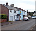
A row of three houses viewed across St Bride's Road, opposite Langley Close. http://www.geograph.org.uk/photo/3712884
Image: © Jaggery Taken: 16 Feb 2012
0.04 miles
2
Bus shelter opposite Queens Gardens, Magor
The shelter is at a bus stop on the B4245 Newport Road in Magor.
Image: © Jaggery Taken: 3 Sep 2013
0.06 miles
3
Langley Close, Magor
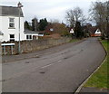
Houses in a cul-de-sac viewed from St Bride's Road opposite Langley Terrace. http://www.geograph.org.uk/photo/3712887
Image: © Jaggery Taken: 16 Feb 2012
0.06 miles
4
Netherwent View, Magor
Netherwent View is a long cul-de-sac on the east side of St Brides Road.
Image: © Jaggery Taken: 16 Feb 2012
0.07 miles
5
Information board and postbox in Magor
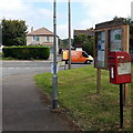
The postbox and Magor with Undy Community Council board are located in Queens Gardens near the Newport Road junction.
Image: © Jaggery Taken: 3 Sep 2013
0.07 miles
6
Newport Road houses, Magor
Houses on the north side of Newport Road, near the turning for Queens Gardens.
Image: © Jaggery Taken: 1 May 2010
0.07 miles
7
Bungalows in The Gardens, Magor
Viewed from St Brides Road. The Gardens is a short cul-de-sac of bungalows.
Image: © Jaggery Taken: 16 Feb 2012
0.08 miles
8
St Brides Close, Magor
Viewed from St Brides Road in the north of Magor.
Image: © Jaggery Taken: 16 Feb 2012
0.08 miles
9
Old-style destination sign in Magor
The sign is alongside St Brides Road on the approach to the Newport Road (B4245) junction.
Image: © Jaggery Taken: 16 Feb 2012
0.09 miles
10
Northern boundary of Magor
A few metres south of passing under the M4 motorway, http://www.geograph.org.uk/photo/3712841 St Brides Road reaches the boundary sign for Magor, a large village in Monmouthshire.
Image: © Jaggery Taken: 16 Feb 2012
0.09 miles
  • ...