IMAGES TAKEN NEAR TO
Rockfield, MONMOUTH, NP25 5PX
Introduction
This page details the photographs taken nearby to NP25 5PX by members of the Geograph project.
The Geograph project started in 2005 with the aim of publishing, organising and preserving representative images for every square kilometre of Great Britain, Ireland and the Isle of Man.

There are currently over 7.5m images from over14,400 individuals and you can help contribute to the project by visiting https://www.geograph.org.uk
Image Map
Images are licensed for reuse under creativecommons.org/licenses/by-sa/2.0
Notes
- Clicking on the map will re-center to the selected point.
- The higher the marker number, the further away the image location is from the centre of the postcode.
Image Listing (9 Images Found)
Images are licensed for reuse under creativecommons.org/licenses/by-sa/2.0
Image
Details
Distance
1
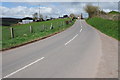
The B4347 passing Porth-y-gaelod
The B4347 passing Porth-y-gaelod near Maypole.
Image: © Philip Halling
Taken: 27 Apr 2013
0.05 miles
2
Porth-y-gaelod
Taken from the same spot as Philip in 2006.
Image
Image: © Pauline E
Taken: 7 Apr 2009
0.06 miles
3
B4347 at Porth-y-gaelod with hot air balloon visible
Image: © Colin Pyle
Taken: 6 May 2012
0.10 miles
4
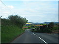
View to Buckholt Wood
View to Buckholt Wood from the B4347 near Maypole.
Image: © Philip Halling
Taken: 27 Apr 2013
0.12 miles
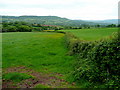
5
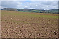
Farmland below Rockfield Farm
Farmland below Rockfield Farm viewed from the B4347.
Image: © Philip Halling
Taken: 27 Apr 2013
0.16 miles
6
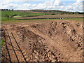
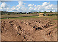
View west from a dry field entrance
Towards Round Wood and Llangattock Great Wood.
Image: © Pauline E
Taken: 7 Apr 2009
0.22 miles
7
View to Whitehouse Farm
Across rolling countryside.
Image: © Pauline E
Taken: 7 Apr 2009
0.23 miles
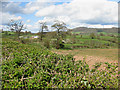
8
View towards the Monnow valley
Looking north-east across to the forestry of Buckholt Hill in the distance.
Image: © Jonathan Billinger
Taken: 22 May 2009
0.23 miles
9
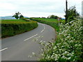
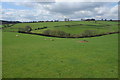
The sinuous B4347
The road winds north-west from Monmouth to Grosmont.
View south-east towards Rockfield.
Image: © Jonathan Billinger
Taken: 22 May 2009
0.24 miles