IMAGES TAKEN NEAR TO
The Hendre, MONMOUTH, NP25 5HQ
Introduction
This page details the photographs taken nearby to NP25 5HQ by members of the Geograph project.
The Geograph project started in 2005 with the aim of publishing, organising and preserving representative images for every square kilometre of Great Britain, Ireland and the Isle of Man.

There are currently over 7.5m images from over14,400 individuals and you can help contribute to the project by visiting https://www.geograph.org.uk
Image Map
Images are licensed for reuse under creativecommons.org/licenses/by-sa/2.0
Notes
- Clicking on the map will re-center to the selected point.
- The higher the marker number, the further away the image location is from the centre of the postcode.
Image Listing (45 Images Found)
Images are licensed for reuse under creativecommons.org/licenses/by-sa/2.0
Image
Details
Distance
1
Inconspicuous warning sign, Hendre, Monmouthshire
A cattle warning sign faces westbound traffic on the B4233 in rural Monmouthshire.
Image: © Jaggery
Taken: 23 Jan 2022
0.07 miles
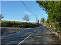
2
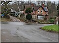
Road and cottage at The Hendre near Monmouth
I always like a cupola.
Image: © Jeremy Bolwell
Taken: 23 Mar 2013
0.07 miles
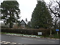
3
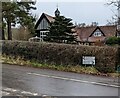
Grade II Listed former village hall, Hendre, Monmouthshire
Set back from the NW corner of crossroads in Hendre. Built as a village hall c1900 for the Hendre estate. Converted to a dwelling in the late 1980s.
Image: © Jaggery
Taken: 23 Jan 2022
0.07 miles
4
Crossroads in Hendre, Monmouthshire
Looking to the north across the B4233 from a minor road towards another minor road.
Image: © Jaggery
Taken: 23 Jan 2022
0.08 miles
5
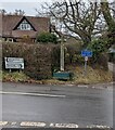
Roadside stone cross, Hendre, Monmouthshire
On the north side of the B4233 11 miles from Abergavenny, 4 miles from Monmouth.
Image: © Jaggery
Taken: 23 Jan 2022
0.09 miles
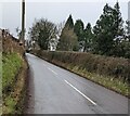
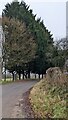
6
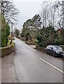
West along the B4233, Hendre, Monmouthshire
Ahead for Abergavenny. Behind the camera for Monmouth.
Image: © Jaggery
Taken: 23 Jan 2022
0.09 miles
7
Hendre Farmhouse B&B direction sign, Hendre, Monmouthshire
The black arrow on the sign points right along this https://www.geograph.org.uk/photo/7094111 road on the south side of the B4233 in rural Monmouthshire.
Image: © Jaggery
Taken: 23 Jan 2022
0.09 miles
8
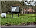
National Speed Limit signs, Hendre, Monmouthshire
Alongside a minor road south of the B4233.
Image: © Jaggery
Taken: 23 Jan 2022
0.09 miles
9
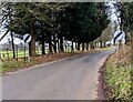
Evergreen trees at the edge of a golf course, Hendre, Monmouthshire
At the western edge of the Rolls of Monmouth golf course viewed in January 2022.
Image: © Jaggery
Taken: 23 Jan 2022
0.09 miles