IMAGES TAKEN NEAR TO
Wonastow Road, MONMOUTH, NP25 5DG

Introduction

This page details the photographs taken nearby to Wonastow Road, NP25 5DG by members of the Geograph project.

The Geograph project started in 2005 with the aim of publishing, organising and preserving representative images for every square kilometre of Great Britain, Ireland and the Isle of Man.

There are currently over 7.5m images from over14,400 individuals and you can help contribute to the project by visiting https://www.geograph.org.uk

Image Map


Images are licensed for reuse under creativecommons.org/licenses/by-sa/2.0
Notes
  • Clicking on the map will re-center to the selected point.
  • The higher the marker number, the further away the image location is from the centre of the postcode.

Image Listing (102 Images Found)

Images are licensed for reuse under creativecommons.org/licenses/by-sa/2.0
  • ...
Image
Details
Distance
1
Apex House, Monmouth
Business centre located on Wonastow Road. Business accommodation is available to rent, from small single rooms to suites of offices.
Image: © Jaggery Taken: 12 Sep 2010
0.02 miles
2
Mandarin Stone, Monmouth
Located on the corner of Wonastow Road and the entrance road to an industrial estate. Mandarin Stone are importers and stockists of natural stone tiles.
Image: © Jaggery Taken: 12 Sep 2010
0.02 miles
3
Drainage channel, Wonastow Road, Monmouth
Drainage channels run for several hundred metres along the north side of Wonastow Road.
Image: © Jaggery Taken: 12 Sep 2010
0.02 miles
4
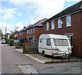
Wonastow Road houses, Monmouth
Viewed from the corner of Wonastow Close. The houses, on the south side of the road, are screened from Wonastow Road by a line of hedges, just out of view on the left.
Image: © Jaggery Taken: 12 Sep 2010
0.02 miles
5
Wonastow Road, Monmouth
Looking SW along Wonastow Road past Apex House Business Centre http://www.geograph.org.uk/photo/2068710 on the right. A white arrow on the blue sign on the left points along National Cycle Network route 423.
Image: © Jaggery Taken: 26 Oct 2014
0.02 miles
6
St Dial's Close,
A cul-de-sac off Wonastow Road. Another unintentional monochrome. In the background is St Dial's Wood.
Image: © Derek Harper Taken: 25 Jun 2021
0.03 miles
7
Entrance to Wonastow Road Industrial Estate
The east entrance.
Image: © Pauline E Taken: 7 Apr 2009
0.03 miles
8
Lockwood Row, Monmouth
A short row of houses on the south side of Wonastow Road.
Image: © Jaggery Taken: 12 Sep 2010
0.04 miles
9
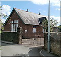
Overmonnow Family Learning Centre, Monmouth
Run by Monmouthshire County Council, the centre is located on the south side of a cul-de-sac named Victoria Estate.
Image: © Jaggery Taken: 12 Sep 2010
0.04 miles
10
Houses on Wonastow Road
And yet these three houses are not directly on the road, as a hedge on the left separates this service road from Wonastow Road itself. At right angles in the background is Lockwood Road. Another monochrome.
Image: © Derek Harper Taken: 25 Jun 2021
0.05 miles
  • ...