1
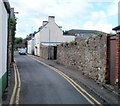
Goldwire Lane, Monmouth
Goldwire Lane heads SW away from Drybridge Street.
Image: © Jaggery
Taken: 12 Sep 2010
0.03 miles
2
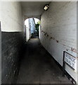
Danger - keep out, Goldwire Lane, Monmouth
It is not obvious exactly what danger is present in this small, fenced-off vacant area on the SE side of Goldwire Lane.
Image: © Jaggery
Taken: 12 Sep 2010
0.03 miles
3
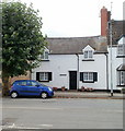
St Gwithian Cottage, Monmouth
Located on Drybridge Street.
Image: © Jaggery
Taken: 12 Sep 2010
0.03 miles
4
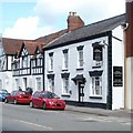
Three Horseshoes, Monmouth
Pub at 21 Drybridge Street, in a row of Tudoresque houses. http://www.geograph.org.uk/photo/2069186
Image: © Jaggery
Taken: 12 Sep 2010
0.03 miles
5
Tudoresque houses, Drybridge Street, Monmouth
Located on the NE section of Drybridge Street.
Image: © Jaggery
Taken: 12 Sep 2010
0.03 miles
6
Jewel Balti, Monmouth
Indian restaurant at 39 Drybridge Street. It opened in November 2009. The building was previously the Britannia pub.
Image: © Jaggery
Taken: 12 Sep 2010
0.03 miles
7
Somerset Road, Monmouth
Viewed from Wonastow Road. The bilingual name sign shows that the Welsh for Somerset is
Gwlad yr haf, meaning Summer Land. Various sources give various origins for the name Somerset.
One is that Sumorsaete (recorded in the Anglo-Saxon Chronicle) means "the people of the summer lands". The Celts, who were here before the Saxons, called it Gwlad yr haf. The Saxons, invading in the later 7th century described the area as the native Celts had described it earlier. In sunshine, the bright green Spring grass of the Somerset Levels can be seen clearly across the Bristol Channel from coastal SE Wales, which perhaps inspired the name.
Image: © Jaggery
Taken: 26 Oct 2014
0.04 miles
8
Drybridge Terrace, Monmouth
Looking to the southwest from Drybridge Street. The sign https://www.geograph.org.uk/photo/6761876 on the right shows that Drybridge Terrace is Teras y Bont Sych in Welsh.
Image: © Jaggery
Taken: 12 Jul 2020
0.04 miles
9
Mini roundabout, Overmonnow
With some pleasant, timbered buildings.
Image: © Pauline E
Taken: 20 Feb 2009
0.04 miles
10
Speed bumps, Overmonnow
A few minutes after I'd taken this photograph a lady in a Peugeot 405 hit the bumps at the wrong angle and lost her exhaust.
The building is part of Bridges Community Centre, and was once the stable block of Drybridge House.
Image: © Pauline E
Taken: 20 Feb 2009
0.04 miles


