IMAGES TAKEN NEAR TO
Upper Redbrook, MONMOUTH, NP25 4LU
Introduction
This page details the photographs taken nearby to NP25 4LU by members of the Geograph project.
The Geograph project started in 2005 with the aim of publishing, organising and preserving representative images for every square kilometre of Great Britain, Ireland and the Isle of Man.

There are currently over 7.5m images from over14,400 individuals and you can help contribute to the project by visiting https://www.geograph.org.uk
Image Map
Images are licensed for reuse under creativecommons.org/licenses/by-sa/2.0
Notes
- Clicking on the map will re-center to the selected point.
- The higher the marker number, the further away the image location is from the centre of the postcode.
Image Listing (54 Images Found)
Images are licensed for reuse under creativecommons.org/licenses/by-sa/2.0
Image
Details
Distance
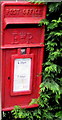
1
Road south from Upper Redbrook towards Redbrook
The red postbox at the edge of a hedge is from the reign of Queen Elizabeth II. http://www.geograph.org.uk/photo/4492057
Image: © Jaggery
Taken: 25 May 2015
0.01 miles
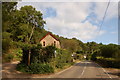
2
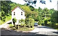
Upper Redbrook
A house between two roads
Image: © Deborah Tilley
Taken: 12 Sep 2015
0.01 miles
3
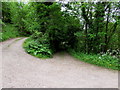
Upper Redbrook side road to Redbrook Equestrian
The side road leads to Redbrook Equestrian Riding School in Cockshoot Ash, Upper Redbrook.
A signpost shows that this route is part of Offa's Dyke Path.
Image: © Jaggery
Taken: 25 May 2015
0.01 miles
4
Queen Elizabeth II postbox, Upper Redbrook
Located here. http://www.geograph.org.uk/photo/4492052
Image: © Jaggery
Taken: 25 May 2015
0.02 miles
5
Offa's Dyke footpath reaches Upper Redbrook
Image: © Roger Davies
Taken: 20 Sep 2009
0.02 miles
6
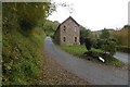
Foot of Duffield's Lane
Upper Redbrook.
Image: © Richard Webb
Taken: 20 Oct 2016
0.03 miles
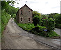
7
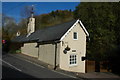
The Old Inn, Upper Redbrook
The Old Inn, Upper Redbrook is on a road which forms the boundary between England and Wales.
Image: © Philip Halling
Taken: 4 Nov 2007
0.06 miles
9
Woodland track junction in Upper Redbrook
About 20 metres east of the road from Redbrook to Newland.
Image: © Jaggery
Taken: 25 May 2015
0.10 miles
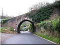
10
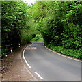
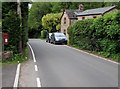
Bilingual road markings in Upper Redbrook
Maps show that the Monmouthshire (Wales) and Gloucestershire (England) boundary is nearby. The Welsh ARAF below SLOW on the road surface suggests either that this is on the Monmouthshire side of the boundary, or that this part of the road is maintained by Monmouthshire County Council.
Image: © Jaggery
Taken: 25 May 2015
0.12 miles